

Laufwoche Mittenwald - München
A cycling route starting in Mittenwald, Bavaria, Germany.
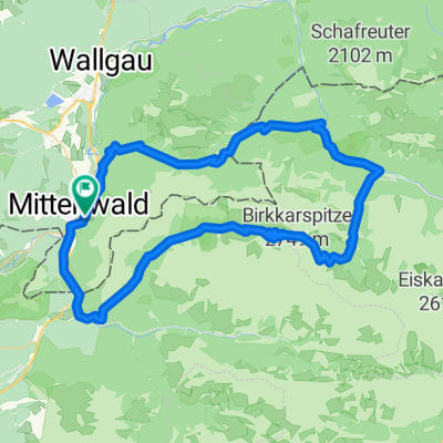
Overview
About this route
- -:--
- Duration
- 128.5 km
- Distance
- 179 m
- Ascent
- 556 m
- Descent
- ---
- Avg. speed
- ---
- Avg. speed

Route quality
Waytypes & surfaces along the route
Waytypes
Path
34.8 km
(27 %)
Quiet road
32.4 km
(25 %)
Surfaces
Paved
88.4 km
(69 %)
Unpaved
36.7 km
(29 %)
Asphalt
81.6 km
(64 %)
Gravel
19.4 km
(15 %)
Route highlights
Points of interest along the route
Accommodation after 35.3 km
1. Übernachtung Jäger Von Fall Ludwig-Ganghofer-Str. 8 83661 Lenggries
Accommodation after 60.5 km
2. Übernachtung BEER Gesundheit Bruckfeldstr. 3 83646 Bad Tölz
Accommodation after 88.4 km
3. Übernachtung Hotel Isartaler Hof Sauerlacher Str. 47d 82515 Wolfratshausen
Drinking water after 116.9 km
Pause am Flaucher
Continue with Bikemap
Use, edit, or download this cycling route
You would like to ride Laufwoche Mittenwald - München or customize it for your own trip? Here is what you can do with this Bikemap route:
Free features
- Save this route as favorite or in collections
- Copy & plan your own version of this route
- Sync your route with Garmin or Wahoo
Premium features
Free trial for 3 days, or one-time payment. More about Bikemap Premium.
- Navigate this route on iOS & Android
- Export a GPX / KML file of this route
- Create your custom printout (try it for free)
- Download this route for offline navigation
Discover more Premium features.
Get Bikemap PremiumFrom our community
Other popular routes starting in Mittenwald
 Unbenannte Route
- Distance
- 120.7 km
- Ascent
- 1,501 m
- Descent
- 1,727 m
- Location
- Mittenwald, Bavaria, Germany
 kurz Miwa Innsbruck
- Distance
- 50.7 km
- Ascent
- 640 m
- Descent
- 877 m
- Location
- Mittenwald, Bavaria, Germany
 Mittenwald-ElmauerAlm-HoherKranzberg-Arnspitzrunde
- Distance
- 70.3 km
- Ascent
- 1,142 m
- Descent
- 1,142 m
- Location
- Mittenwald, Bavaria, Germany
 Karwendelrunde light - Mittenwald - Scharnitz - Karwendelhaus - Hinterriss - Vorderriss - Wallgau
- Distance
- 75.5 km
- Ascent
- 1,530 m
- Descent
- 1,530 m
- Location
- Mittenwald, Bavaria, Germany
 Lautersee-wettersteinalm-ellmau-lautersee
- Distance
- 22.9 km
- Ascent
- 558 m
- Descent
- 558 m
- Location
- Mittenwald, Bavaria, Germany
 Letzte Etappe Ulm-Gardasee-Ulm
- Distance
- 214.9 km
- Ascent
- 1,305 m
- Descent
- 1,666 m
- Location
- Mittenwald, Bavaria, Germany
 Karwendelrunde
- Distance
- 65 km
- Ascent
- 1,582 m
- Descent
- 1,572 m
- Location
- Mittenwald, Bavaria, Germany
 -> Ferein Alm -> Karwendelhaus
- Distance
- 67.7 km
- Ascent
- 1,579 m
- Descent
- 1,576 m
- Location
- Mittenwald, Bavaria, Germany
Open it in the app