

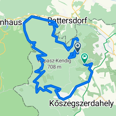
Kőszegi-hg -- Kincs-pihenő - Hét vezér forrás - Zeiger-nyereg - Vörös-kereszt - Stájer-házak - Hörmann-forrás - Terv-út
A cycling route starting in Kőszeg, Vas, Hungary.
Overview
About this route
- -:--
- Duration
- 23.7 km
- Distance
- 469 m
- Ascent
- 469 m
- Descent
- ---
- Avg. speed
- ---
- Avg. speed

Continue with Bikemap
Use, edit, or download this cycling route
You would like to ride Kőszegi-hg -- Kincs-pihenő - Hét vezér forrás - Zeiger-nyereg - Vörös-kereszt - Stájer-házak - Hörmann-forrás - Terv-út or customize it for your own trip? Here is what you can do with this Bikemap route:
Free features
- Save this route as favorite or in collections
- Copy & plan your own version of this route
- Sync your route with Garmin or Wahoo
Premium features
Free trial for 3 days, or one-time payment. More about Bikemap Premium.
- Navigate this route on iOS & Android
- Export a GPX / KML file of this route
- Create your custom printout (try it for free)
- Download this route for offline navigation
Discover more Premium features.
Get Bikemap PremiumFrom our community
Other popular routes starting in Kőszeg
 Kőszeg-Velem-Cák
- Distance
- 44.2 km
- Ascent
- 720 m
- Descent
- 816 m
- Location
- Kőszeg, Vas, Hungary
 Bringahorda 2018 opt1.3
- Distance
- 170.7 km
- Ascent
- 847 m
- Descent
- 847 m
- Location
- Kőszeg, Vas, Hungary
 Kőszeg- Ausztria várak
- Distance
- 78 km
- Ascent
- 1,236 m
- Descent
- 1,239 m
- Location
- Kőszeg, Vas, Hungary
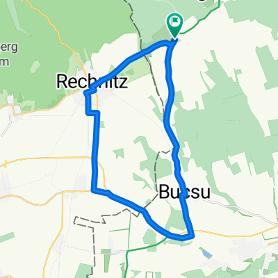 VELOREGIO_08.
- Distance
- 23.9 km
- Ascent
- 134 m
- Descent
- 134 m
- Location
- Kőszeg, Vas, Hungary
 "Csúnya"-kör
- Distance
- 5.1 km
- Ascent
- 130 m
- Descent
- 130 m
- Location
- Kőszeg, Vas, Hungary
 Köszeg-Hochwechsel-Köszeg Tour 2
- Distance
- 167.1 km
- Ascent
- 2,732 m
- Descent
- 2,690 m
- Location
- Kőszeg, Vas, Hungary
 VELOREGIO_15
- Distance
- 50.2 km
- Ascent
- 255 m
- Descent
- 254 m
- Location
- Kőszeg, Vas, Hungary
 Kőszeg-Szombathely
- Distance
- 59.4 km
- Ascent
- 240 m
- Descent
- 234 m
- Location
- Kőszeg, Vas, Hungary
Open it in the app