

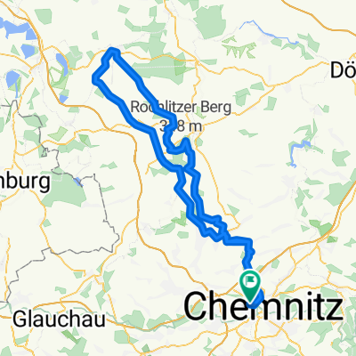
RK Chemnitz - Wechselburg - Mittweida
A cycling route starting in Chemnitz, Saxony, Germany.
Overview
About this route
Endlich wieder Radwetter-obwohl es eigentlich gar nicht so gemeldet wurde.Also rauf aufs Rad und ab in die Natur-davon gab es heute viel-viel Ruhe,viel Grün,viel Wasser,viele schöne Aussichten. Von Chemnitz ging es an der Chemnitz entlang bis zum Zusammenfluss der Chemnitz in die Mulde. Das ist zwar unspektakulär aber total entspannend. Weiter geht es nach Wechselburg zur Basilika und von dort über die Dörfer zurück. In Topfseifersdorf gab es beim Dorffest leckeren hausgemachten Kuchen für wenig Geld.
- -:--
- Duration
- 82.2 km
- Distance
- 402 m
- Ascent
- 401 m
- Descent
- ---
- Avg. speed
- ---
- Avg. speed

Route quality
Waytypes & surfaces along the route
Waytypes
Road
18.7 km
(23 %)
Quiet road
16.9 km
(21 %)
Surfaces
Paved
65.4 km
(80 %)
Unpaved
7.7 km
(9 %)
Asphalt
60.4 km
(73 %)
Paving stones
3.9 km
(5 %)
Continue with Bikemap
Use, edit, or download this cycling route
You would like to ride RK Chemnitz - Wechselburg - Mittweida or customize it for your own trip? Here is what you can do with this Bikemap route:
Free features
- Save this route as favorite or in collections
- Copy & plan your own version of this route
- Sync your route with Garmin or Wahoo
Premium features
Free trial for 3 days, or one-time payment. More about Bikemap Premium.
- Navigate this route on iOS & Android
- Export a GPX / KML file of this route
- Create your custom printout (try it for free)
- Download this route for offline navigation
Discover more Premium features.
Get Bikemap PremiumFrom our community
Other popular routes starting in Chemnitz
 Zschopextreme
- Distance
- 47.7 km
- Ascent
- 675 m
- Descent
- 677 m
- Location
- Chemnitz, Saxony, Germany
 Zeisig-HELLYEAH-wald-1.0
- Distance
- 19.9 km
- Ascent
- 186 m
- Descent
- 186 m
- Location
- Chemnitz, Saxony, Germany
 Raben-Toten-Hohen-stein-Runde
- Distance
- 41.4 km
- Ascent
- 393 m
- Descent
- 397 m
- Location
- Chemnitz, Saxony, Germany
 Chemnitz - Kohren Salis
- Distance
- 96.3 km
- Ascent
- 522 m
- Descent
- 526 m
- Location
- Chemnitz, Saxony, Germany
 Chemnitz Küchwald - Kriebstein und zurück
- Distance
- 71.5 km
- Ascent
- 567 m
- Descent
- 567 m
- Location
- Chemnitz, Saxony, Germany
 West- Nord- Runde (Grüna, Glöse, ...)
- Distance
- 49.8 km
- Ascent
- 339 m
- Descent
- 339 m
- Location
- Chemnitz, Saxony, Germany
 Abendrunde I
- Distance
- 30.6 km
- Ascent
- 218 m
- Descent
- 218 m
- Location
- Chemnitz, Saxony, Germany
 Chemnitz - Rochlitzer Berg - Bad Lausick - Chemnitz 2
- Distance
- 108.4 km
- Ascent
- 546 m
- Descent
- 543 m
- Location
- Chemnitz, Saxony, Germany