

Enz-Kleinenz
A cycling route starting in Enzklösterle, Baden-Württemberg, Germany.
Overview
About this route
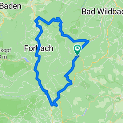
Von der Kälbermühle über das Kälbertal nach Aichelberg. Weiter über Hünerberg hinunter ins Kleinenztal zur Agenbacher Sägemühle. Kleinenz abwärts vorbei am Forellenpark zum Kleinenzhof und weiter nach Calmbach. Weiter über die alte Wildbader Straße und den Enztalradweg zurück zum Startpunkt
- -:--
- Duration
- 38.3 km
- Distance
- 599 m
- Ascent
- 601 m
- Descent
- ---
- Avg. speed
- ---
- Avg. speed
Continue with Bikemap
Use, edit, or download this cycling route
You would like to ride Enz-Kleinenz or customize it for your own trip? Here is what you can do with this Bikemap route:
Free features
- Save this route as favorite or in collections
- Copy & plan your own version of this route
- Sync your route with Garmin or Wahoo
Premium features
Free trial for 3 days, or one-time payment. More about Bikemap Premium.
- Navigate this route on iOS & Android
- Export a GPX / KML file of this route
- Create your custom printout (try it for free)
- Download this route for offline navigation
Discover more Premium features.
Get Bikemap PremiumFrom our community
Other popular routes starting in Enzklösterle
 Vom Ursprung der Enz bis zum Enzkreis
- Distance
- 52.1 km
- Ascent
- 184 m
- Descent
- 650 m
- Location
- Enzklösterle, Baden-Württemberg, Germany
 Enztal-Murgtal-Kaltenbronner Wand
- Distance
- 64.3 km
- Ascent
- 1,613 m
- Descent
- 1,486 m
- Location
- Enzklösterle, Baden-Württemberg, Germany
 Schwarzwald-3__Enzklösterle-Besenfeld
- Distance
- 17.3 km
- Ascent
- 398 m
- Descent
- 163 m
- Location
- Enzklösterle, Baden-Württemberg, Germany
 Enz und Eyach CLONED FROM ROUTE 245
- Distance
- 49.7 km
- Ascent
- 776 m
- Descent
- 776 m
- Location
- Enzklösterle, Baden-Württemberg, Germany
 Enz und Eyach
- Distance
- 49.7 km
- Ascent
- 776 m
- Descent
- 776 m
- Location
- Enzklösterle, Baden-Württemberg, Germany
 Enz-Eyach-Rohnbach
- Distance
- 53.6 km
- Ascent
- 685 m
- Descent
- 685 m
- Location
- Enzklösterle, Baden-Württemberg, Germany
 Enztalradweg, Bad Wildbad, Grünhütte, Kaltenbronn, Hohlohturm, Gompelscheuer, Enztalquelle
- Distance
- 58 km
- Ascent
- 1,897 m
- Descent
- 1,887 m
- Location
- Enzklösterle, Baden-Württemberg, Germany
 02_Mittelenztal-Baiersbronn
- Distance
- 43.3 km
- Ascent
- 1,083 m
- Descent
- 1,199 m
- Location
- Enzklösterle, Baden-Württemberg, Germany
Open it in the app