

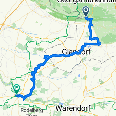
Teutoburger Wald - Osnabrücker Land
A cycling route starting in Bad Iburg, Lower Saxony, Germany.
Overview
About this route
- Mai 2017: Hügelige Radrunde von Bad Iburg (Teutoburger Wald) über Hagen, Hasbergen, Kloster Oesede zurück nach Bad Iburg.
- -:--
- Duration
- 47.7 km
- Distance
- 280 m
- Ascent
- 284 m
- Descent
- ---
- Avg. speed
- ---
- Avg. speed

Route quality
Waytypes & surfaces along the route
Waytypes
Quiet road
24.9 km
(52 %)
Busy road
6.6 km
(14 %)
Surfaces
Paved
33.7 km
(71 %)
Unpaved
3.3 km
(7 %)
Asphalt
28.3 km
(59 %)
Paving stones
3.2 km
(7 %)
Continue with Bikemap
Use, edit, or download this cycling route
You would like to ride Teutoburger Wald - Osnabrücker Land or customize it for your own trip? Here is what you can do with this Bikemap route:
Free features
- Save this route as favorite or in collections
- Copy & plan your own version of this route
- Sync your route with Garmin or Wahoo
Premium features
Free trial for 3 days, or one-time payment. More about Bikemap Premium.
- Navigate this route on iOS & Android
- Export a GPX / KML file of this route
- Create your custom printout (try it for free)
- Download this route for offline navigation
Discover more Premium features.
Get Bikemap PremiumFrom our community
Other popular routes starting in Bad Iburg
 Bad Iburg-Glandorf-Kloster Vinnenberg-Warendorf-Westkirchen-Oelde
- Distance
- 60 km
- Ascent
- 240 m
- Descent
- 280 m
- Location
- Bad Iburg, Lower Saxony, Germany
 Mountainbike Touren ± 2,5 uur
- Distance
- 21 km
- Ascent
- 415 m
- Descent
- 417 m
- Location
- Bad Iburg, Lower Saxony, Germany
 Ahornweg kurz
- Distance
- 38.4 km
- Ascent
- 559 m
- Descent
- 604 m
- Location
- Bad Iburg, Lower Saxony, Germany
 Bad Iburg lang un schmutzig
- Distance
- 30.4 km
- Ascent
- 698 m
- Descent
- 698 m
- Location
- Bad Iburg, Lower Saxony, Germany
 Teutotour 2009
- Distance
- 41.1 km
- Ascent
- 655 m
- Descent
- 654 m
- Location
- Bad Iburg, Lower Saxony, Germany
 MTB 17.09.2020
- Distance
- 15.9 km
- Ascent
- 413 m
- Descent
- 413 m
- Location
- Bad Iburg, Lower Saxony, Germany
 Glane-Lengering-Lienen-Glane
- Distance
- 45.3 km
- Ascent
- 69 m
- Descent
- 70 m
- Location
- Bad Iburg, Lower Saxony, Germany
 FR04_Bad-Iburg-Telgte
- Distance
- 47.3 km
- Ascent
- 148 m
- Descent
- 228 m
- Location
- Bad Iburg, Lower Saxony, Germany
Open it in the app