

20170523_092245.gpx
A cycling route starting in Mömbris, Bavaria, Germany.
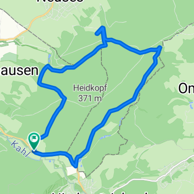
Overview
About this route
TAHUNA track
- -:--
- Duration
- 79.4 km
- Distance
- 150 m
- Ascent
- 213 m
- Descent
- ---
- Avg. speed
- ---
- Avg. speed

Route quality
Waytypes & surfaces along the route
Waytypes
Path
20.8 km
(26 %)
Quiet road
20.8 km
(26 %)
Surfaces
Paved
64.5 km
(81 %)
Unpaved
8.7 km
(11 %)
Asphalt
56.9 km
(72 %)
Gravel
5.3 km
(7 %)
Continue with Bikemap
Use, edit, or download this cycling route
You would like to ride 20170523_092245.gpx or customize it for your own trip? Here is what you can do with this Bikemap route:
Free features
- Save this route as favorite or in collections
- Copy & plan your own version of this route
- Sync your route with Garmin or Wahoo
Premium features
Free trial for 3 days, or one-time payment. More about Bikemap Premium.
- Navigate this route on iOS & Android
- Export a GPX / KML file of this route
- Create your custom printout (try it for free)
- Download this route for offline navigation
Discover more Premium features.
Get Bikemap PremiumFrom our community
Other popular routes starting in Mömbris
 Rund um den Hahnenkamm
- Distance
- 49.3 km
- Ascent
- 491 m
- Descent
- 492 m
- Location
- Mömbris, Bavaria, Germany
 Alzenau Dörstehöfe - Fernblick
- Distance
- 11.7 km
- Ascent
- 388 m
- Descent
- 388 m
- Location
- Mömbris, Bavaria, Germany
 Berg und Tal
- Distance
- 46.7 km
- Ascent
- 731 m
- Descent
- 729 m
- Location
- Mömbris, Bavaria, Germany
 Runde A'burg Umland
- Distance
- 47.3 km
- Ascent
- 882 m
- Descent
- 875 m
- Location
- Mömbris, Bavaria, Germany
 Ehemaliger Eu-Mittelpunkt und Kahlgrund
- Distance
- 30.7 km
- Ascent
- 447 m
- Descent
- 447 m
- Location
- Mömbris, Bavaria, Germany
 von Strötzbach zum Engländer und zurück
- Distance
- 45.2 km
- Ascent
- 453 m
- Descent
- 452 m
- Location
- Mömbris, Bavaria, Germany
 Der Berg ruft (Rückersbacher Schlucht)
- Distance
- 35.9 km
- Ascent
- 493 m
- Descent
- 497 m
- Location
- Mömbris, Bavaria, Germany
 Mömbris - Walldürn
- Distance
- 83.6 km
- Ascent
- 597 m
- Descent
- 445 m
- Location
- Mömbris, Bavaria, Germany
Open it in the app