Premium Badge Download on the App Store Get it on Google Play Turn-by-turn Navigation Offline Maps Bike Type Optimized Routing Premium Maps Custom Bike Computer Export Routes Route Previews Fall Detection Premium Support

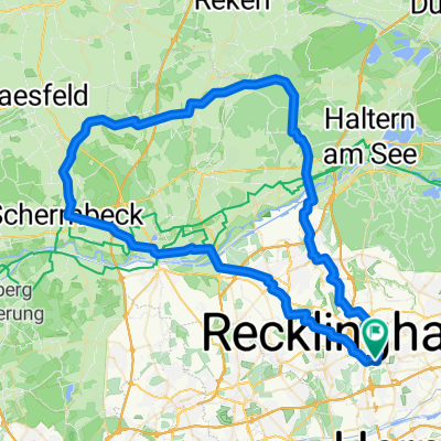
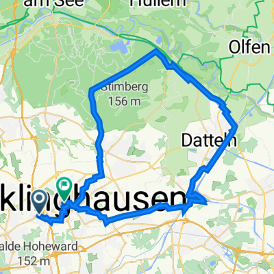
Cycling Route in Recklinghausen, North Rhine-Westphalia, Germany

RE-Haardt-Flaesheim-TÜP Reken-RE 54km

2
Open this route in the Bikemap app

Open this route in the Bikemap app

Open this route in Bikemap Web

Open this route in Bikemap Web

55 km
Distance
338 m
Ascent
337 m
Descent
-:-- h
Duration
-- km/h
Avg. Speed
--- m
Max. Elevation

About This Route

Die Strecke beginnt in Re, führt dann durch die Haardt nach Flaesheim, weiter zum Stausee Hullern und durch den Truppenübungsplatz. Dieser ist verlassen, dennoch irgendwie unheimlich. Sollte der Platz benutzt sein, sollte, laut Aussagen einiger Anwohner, eine rote Fahne gehisst sein. Das Highlight sind sicherlich die zerschossenen Panzer, wie gesagt, so richtig wohl fühlt mach sich dort nicht. Weiter gehts am Kanal entlang, durch die Haardt und zurück nach RE! Habe etwa 3 Stunden gebraucht, einige Wege sind aber auch sehr verwachsen oder mit Bäumen versperrt, so dass man das Rad tragen muss! Ansonsten is von Asphalt, Schotter und Sand jeder Belag vorhanden und die Breite der Wege variiert stark, von Single Trail bis Landstraße!

This cycling route is ideal for: Road bike

You will cycle on the following surfaces: Paved

Customize this cycling route with the Bikemap route planner.

Make it yours!

Did you know? You can use this route as a template in our cycling route planner if you don't wish to start from scratch. Customize it based on your needs to plan your perfect cycling tour.

Open it in the app