

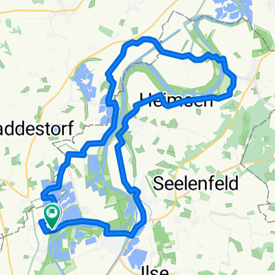
Fronleichnam 2016
A cycling route starting in Raddestorf, Lower Saxony, Germany.
Overview
About this route
- -:--
- Duration
- 59.4 km
- Distance
- 48 m
- Ascent
- 48 m
- Descent
- ---
- Avg. speed
- ---
- Avg. speed

Route quality
Waytypes & surfaces along the route
Waytypes
Quiet road
35.8 km
(60 %)
Road
11.5 km
(19 %)
Surfaces
Paved
55.7 km
(94 %)
Unpaved
1.4 km
(2 %)
Asphalt
54.7 km
(92 %)
Paving stones
0.7 km
(1 %)
Route highlights
Points of interest along the route

Point of interest after 17.7 km
Restaurant Weserscheune
Point of interest after 25.4 km
Scheunenviertel
Point of interest after 26.2 km
Schlüsselburg mit Strochennest

Point of interest after 27.5 km
Rittergut Schlüsselburg

Point of interest after 31.3 km
Heringsfängermuseum
Point of interest after 31.5 km
Biergarten mit Weserblick
Point of interest after 38.5 km
Gaststätte Zur Gehle
Point of interest after 38.8 km
Landhotel Lange

Point of interest after 39.3 km
Wassermühle Döhren

Point of interest after 42.3 km
Strochenmuseum und Cafe
Continue with Bikemap
Use, edit, or download this cycling route
You would like to ride Fronleichnam 2016 or customize it for your own trip? Here is what you can do with this Bikemap route:
Free features
- Save this route as favorite or in collections
- Copy & plan your own version of this route
- Sync your route with Garmin or Wahoo
Premium features
Free trial for 3 days, or one-time payment. More about Bikemap Premium.
- Navigate this route on iOS & Android
- Export a GPX / KML file of this route
- Create your custom printout (try it for free)
- Download this route for offline navigation
Discover more Premium features.
Get Bikemap PremiumFrom our community
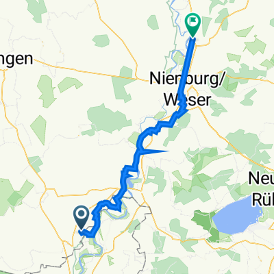
Other popular routes starting in Raddestorf
 Friedewalde
- Distance
- 18.2 km
- Ascent
- 31 m
- Descent
- 13 m
- Location
- Raddestorf, Lower Saxony, Germany
 Fähre Hävern - Fähre Schweringen
- Distance
- 57.4 km
- Ascent
- 26 m
- Descent
- 41 m
- Location
- Raddestorf, Lower Saxony, Germany
 Storchenroute (Nordteil)
- Distance
- 33.4 km
- Ascent
- 47 m
- Descent
- 46 m
- Location
- Raddestorf, Lower Saxony, Germany
 Großenheerser Mühle 4, Petershagen nach Dorfstraße 18, Rohrsen
- Distance
- 46.8 km
- Ascent
- 31 m
- Descent
- 87 m
- Location
- Raddestorf, Lower Saxony, Germany
 Matjesroute
- Distance
- 18.6 km
- Ascent
- 48 m
- Descent
- 45 m
- Location
- Raddestorf, Lower Saxony, Germany
 Weserradweg - ADFC - Empfehlung 2011
- Distance
- 85.1 km
- Ascent
- 26 m
- Descent
- 49 m
- Location
- Raddestorf, Lower Saxony, Germany
 Bückeburg-Wasserstraßenkreutz-Findlingsgarten
- Distance
- 85.5 km
- Ascent
- 159 m
- Descent
- 159 m
- Location
- Raddestorf, Lower Saxony, Germany
 Fronleichnam 2016
- Distance
- 59.4 km
- Ascent
- 48 m
- Descent
- 48 m
- Location
- Raddestorf, Lower Saxony, Germany
Open it in the app