

2017_Dolomitentage 4
A cycling route starting in Canazei, Trentino-Alto Adige, Italy.
Overview
About this route
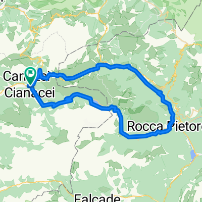
von Canazei über den Radweg Val di Fassa bis Moena dann hinauf zum Pso di San Pellegrino
anschließend wieder zurück über Moena nach Canazei
- -:--
- Duration
- 61.9 km
- Distance
- 1,129 m
- Ascent
- 1,129 m
- Descent
- ---
- Avg. speed
- ---
- Avg. speed

Route quality
Waytypes & surfaces along the route
Waytypes
Busy road
20.7 km
(33 %)
Track
19.5 km
(31 %)
Surfaces
Paved
20.7 km
(33 %)
Unpaved
18.7 km
(30 %)
Asphalt
19.7 km
(32 %)
Gravel
15.8 km
(26 %)
Continue with Bikemap
Use, edit, or download this cycling route
You would like to ride 2017_Dolomitentage 4 or customize it for your own trip? Here is what you can do with this Bikemap route:
Free features
- Save this route as favorite or in collections
- Copy & plan your own version of this route
- Sync your route with Garmin or Wahoo
Premium features
Free trial for 3 days, or one-time payment. More about Bikemap Premium.
- Navigate this route on iOS & Android
- Export a GPX / KML file of this route
- Create your custom printout (try it for free)
- Download this route for offline navigation
Discover more Premium features.
Get Bikemap PremiumFrom our community
Other popular routes starting in Canazei
 Passo delle Erbe
- Distance
- 138.5 km
- Ascent
- 3,686 m
- Descent
- 3,661 m
- Location
- Canazei, Trentino-Alto Adige, Italy
 Sellaronda Trail Running 2015
- Distance
- 59 km
- Ascent
- 3,229 m
- Descent
- 3,228 m
- Location
- Canazei, Trentino-Alto Adige, Italy
 MTB Sellaronda Camp_3 diena_Sella ring tour
- Distance
- 48.6 km
- Ascent
- 1,506 m
- Descent
- 2,341 m
- Location
- Canazei, Trentino-Alto Adige, Italy
 DO_3_Passo Pordoi_CAVALESE
- Distance
- 55.4 km
- Ascent
- 45 m
- Descent
- 1,445 m
- Location
- Canazei, Trentino-Alto Adige, Italy
 Sella Ronda
- Distance
- 51.5 km
- Ascent
- 1,601 m
- Descent
- 1,633 m
- Location
- Canazei, Trentino-Alto Adige, Italy
 Sellaronda
- Distance
- 63.3 km
- Ascent
- 1,977 m
- Descent
- 1,970 m
- Location
- Canazei, Trentino-Alto Adige, Italy
 Canazei - Fedaia - Pordoi - Canazei
- Distance
- 55.4 km
- Ascent
- 2,776 m
- Descent
- 2,776 m
- Location
- Canazei, Trentino-Alto Adige, Italy
 Campitello Selva Gardena
- Distance
- 43 km
- Ascent
- 1,593 m
- Descent
- 1,591 m
- Location
- Canazei, Trentino-Alto Adige, Italy
Open it in the app