

Vorharz, Benneckenstein, Endorf
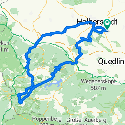
A cycling route starting in Harsleben, Saxony-Anhalt, Germany.
Overview
About this route
Anspruchsvolle Tour mit vielen Auf und Ab
- -:--
- Duration
- 167 km
- Distance
- 816 m
- Ascent
- 817 m
- Descent
- ---
- Avg. speed
- ---
- Avg. speed

Route quality
Waytypes & surfaces along the route
Waytypes
Track
77.9 km
(47 %)
Quiet road
24.8 km
(15 %)
Surfaces
Paved
54.9 km
(33 %)
Unpaved
88.2 km
(53 %)
Gravel
57.1 km
(34 %)
Asphalt
47.7 km
(29 %)
Route highlights
Points of interest along the route

Point of interest after 23.4 km
Am Volkmarskeller im Klostergrung

Point of interest after 37.7 km
Schutzhütte im Steinbachtal zwischen Drei Annen Hohne und Königshütte

Point of interest after 46.9 km
Imbiss in Tanne Mo - Fr 6.30 - 16.00

Point of interest after 49.1 km
Standort alter Bahnhof von Sorge

Point of interest after 65.3 km
Carlshausturm

Point of interest after 73.5 km
Haltepunkt Birkenmoor der Selketalbahn bei Stiege

Point of interest after 80.6 km
Raststube Breitenstein von Friedrichshöhe kommend Mo - Fr 8.00 - 15.00

Point of interest after 88.8 km
Kiliansteich bei Straßberg

Point of interest after 90.3 km
Heiligenbergsquelle bei Straßberg

Point of interest after 99.4 km
Teufelsteich zwischen Harzgerode und Neudorf

Point of interest after 117 km
Landschaftspark Degenershausen zwischen Gartenhaus und Endorf

Point of interest after 122.5 km
Windmühle Endorf

Point of interest after 125.9 km
Konradsburg bei Ermsleben

Point of interest after 145.5 km
Altes Eisenbahn-Viadukt zwischen Bückemühle ( Bad Suderode ) und Quarmbeck

Point of interest after 156.7 km
Kiessee bei Ditfurt
Continue with Bikemap
Use, edit, or download this cycling route
You would like to ride Vorharz, Benneckenstein, Endorf or customize it for your own trip? Here is what you can do with this Bikemap route:
Free features
- Save this route as favorite or in collections
- Copy & plan your own version of this route
- Sync your route with Garmin or Wahoo
Premium features
Free trial for 3 days, or one-time payment. More about Bikemap Premium.
- Navigate this route on iOS & Android
- Export a GPX / KML file of this route
- Create your custom printout (try it for free)
- Download this route for offline navigation
Discover more Premium features.
Get Bikemap PremiumFrom our community
Other popular routes starting in Harsleben
 Die Lange
- Distance
- 111.7 km
- Ascent
- 728 m
- Descent
- 727 m
- Location
- Harsleben, Saxony-Anhalt, Germany
 Hochwasser-Tour 27.7.17
- Distance
- 47 km
- Ascent
- 102 m
- Descent
- 102 m
- Location
- Harsleben, Saxony-Anhalt, Germany
 Kaffeefahrt zur Roten Mühle
- Distance
- 64.9 km
- Ascent
- 493 m
- Descent
- 497 m
- Location
- Harsleben, Saxony-Anhalt, Germany
 Transall - Ballenstedt
- Distance
- 98.1 km
- Ascent
- 577 m
- Descent
- 577 m
- Location
- Harsleben, Saxony-Anhalt, Germany
 Brocken bis Selketal
- Distance
- 167.4 km
- Ascent
- 1,269 m
- Descent
- 1,269 m
- Location
- Harsleben, Saxony-Anhalt, Germany
 Hängebrücke auf Umwegen
- Distance
- 133.2 km
- Ascent
- 858 m
- Descent
- 858 m
- Location
- Harsleben, Saxony-Anhalt, Germany
 Ostharz von Selke bis Bode
- Distance
- 116.6 km
- Ascent
- 913 m
- Descent
- 911 m
- Location
- Harsleben, Saxony-Anhalt, Germany
 Brocken und Huy
- Distance
- 150.7 km
- Ascent
- 1,103 m
- Descent
- 1,100 m
- Location
- Harsleben, Saxony-Anhalt, Germany
Open it in the app