

Slovakia_2
A cycling route starting in Poprad, Prešovský kraj, Slovak Republic.
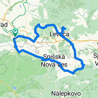
Overview
About this route
24th: arrival to Poprad in the evening
25th: cycle to Strbske pleso (30km, ascent 580,descent 50), hike there
26th. hike near strbske pleso (skok waterfall)
27th. strbske pleso-> Spisske Pohradie(80 km, descent from 1240 to 462 km), visit Kezmarok, Levoca
28th Spisske Pohradie->Hrabushize (slovanian paradise: sucha bela)
29th prielom hornadu
29th Hrabushize->Dedinky (29 km, ascent from 445m to 1025 lasting for 30 km)
30th Dedinky->Rozniava(43 km, descent from 786 to 274 m), visit Dobšinska ledová jeskyně
31th Rozniava caves
1st Rozniava ->Kosize (90 km, ascent 15 km 378-522)
2nd; walk in Kosize 23:15 bus to Uzgorod
3rd; 16:49 -train from Ujgorod to Kyiv
- -:--
- Duration
- 354.8 km
- Distance
- 2,477 m
- Ascent
- 2,940 m
- Descent
- ---
- Avg. speed
- ---
- Avg. speed

Route quality
Waytypes & surfaces along the route
Waytypes
Busy road
186.1 km
(52 %)
Road
54 km
(15 %)
Surfaces
Paved
216.7 km
(61 %)
Unpaved
32 km
(9 %)
Asphalt
212.6 km
(60 %)
Unpaved (undefined)
16.4 km
(5 %)
Route highlights
Points of interest along the route
Point of interest after 32.8 km
Skok waterfall
Point of interest after 32.9 km
Pleso nad skokom
Point of interest after 33.1 km
Popradske pleso
Point of interest after 33.1 km
Velke hincovo pleso
Point of interest after 130.1 km
Spiš Castle
Point of interest after 162.6 km
start of prielom hornadu
Point of interest after 165 km
Tomášovský výhľad
Point of interest after 170.7 km
Prielom Hornádu(end)
Point of interest after 172.3 km
start of sucha bela
Point of interest after 193.6 km
Dobšinska ledová jeskyně
Point of interest after 201.9 km
Zejmarská roklina
Point of interest after 230.1 km
Kastiel Andrassyovcov
Point of interest after 235.9 km
Silická ladnica
Point of interest after 240.7 km
Krásnohorská jaskyňa
Point of interest after 242.9 km
Hrad Krasna Horka
Continue with Bikemap
Use, edit, or download this cycling route
You would like to ride Slovakia_2 or customize it for your own trip? Here is what you can do with this Bikemap route:
Free features
- Save this route as favorite or in collections
- Copy & plan your own version of this route
- Sync your route with Garmin or Wahoo
Premium features
Free trial for 3 days, or one-time payment. More about Bikemap Premium.
- Navigate this route on iOS & Android
- Export a GPX / KML file of this route
- Create your custom printout (try it for free)
- Download this route for offline navigation
Discover more Premium features.
Get Bikemap PremiumFrom our community
Other popular routes starting in Poprad
 Poprad- Svit- Šuňava- Štrba
- Distance
- 23.6 km
- Ascent
- 368 m
- Descent
- 221 m
- Location
- Poprad, Prešovský kraj, Slovak Republic
 Poprad- V.Lomnica- Tat. Lomnica- Štart
- Distance
- 26.8 km
- Ascent
- 668 m
- Descent
- 185 m
- Location
- Poprad, Prešovský kraj, Slovak Republic
 Poprad - Lopušná dolina
- Distance
- 24.9 km
- Ascent
- 280 m
- Descent
- 280 m
- Location
- Poprad, Prešovský kraj, Slovak Republic
 Poprad- N.Lesná- Hrebienok
- Distance
- 17.6 km
- Ascent
- 645 m
- Descent
- 49 m
- Location
- Poprad, Prešovský kraj, Slovak Republic
 Poprad- N.Lesná- Gerlachov- Batizovce
- Distance
- 30.7 km
- Ascent
- 300 m
- Descent
- 298 m
- Location
- Poprad, Prešovský kraj, Slovak Republic
 Svit - Batizovce (okruh)
- Distance
- 20.3 km
- Ascent
- 73 m
- Descent
- 71 m
- Location
- Poprad, Prešovský kraj, Slovak Republic
 VKS 25 Hôrka okruh 88/1500
- Distance
- 87.7 km
- Ascent
- 1,509 m
- Descent
- 1,505 m
- Location
- Poprad, Prešovský kraj, Slovak Republic
 Poprad- Hozelec- Pusté Pole- Žákovce- Vrbov
- Distance
- 16.3 km
- Ascent
- 167 m
- Descent
- 194 m
- Location
- Poprad, Prešovský kraj, Slovak Republic
Open it in the app