

Ketzersbergrunde 2
A cycling route starting in Ellhofen, Baden-Württemberg, Germany.
Overview
About this route
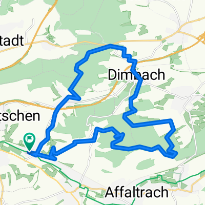
Ketzersberg - Willsbach - Affaltrach - Breitenauer See - Reisach - Seemühle - Oberheinriet - Lehrensteinsfeld - Ellhofen - Ketzersberg
- -:--
- Duration
- 31.2 km
- Distance
- 438 m
- Ascent
- 442 m
- Descent
- ---
- Avg. speed
- ---
- Avg. speed

Route quality
Waytypes & surfaces along the route
Waytypes
Track
16.2 km
(52 %)
Quiet road
5.2 km
(17 %)
Surfaces
Paved
22.1 km
(71 %)
Unpaved
6.5 km
(21 %)
Asphalt
21.2 km
(68 %)
Gravel
3.8 km
(12 %)
Continue with Bikemap
Use, edit, or download this cycling route
You would like to ride Ketzersbergrunde 2 or customize it for your own trip? Here is what you can do with this Bikemap route:
Free features
- Save this route as favorite or in collections
- Copy & plan your own version of this route
- Sync your route with Garmin or Wahoo
Premium features
Free trial for 3 days, or one-time payment. More about Bikemap Premium.
- Navigate this route on iOS & Android
- Export a GPX / KML file of this route
- Create your custom printout (try it for free)
- Download this route for offline navigation
Discover more Premium features.
Get Bikemap PremiumFrom our community
Other popular routes starting in Ellhofen
 Streuobsttour
- Distance
- 34.3 km
- Ascent
- 282 m
- Descent
- 282 m
- Location
- Ellhofen, Baden-Württemberg, Germany
 Wein, Wald, 11, 12, und 13
- Distance
- 20.1 km
- Ascent
- 413 m
- Descent
- 340 m
- Location
- Ellhofen, Baden-Württemberg, Germany
 GRA rappach eschenau OSU GRA
- Distance
- 24.8 km
- Ascent
- 189 m
- Descent
- 190 m
- Location
- Ellhofen, Baden-Württemberg, Germany
 Radtour Spargel Lösch
- Distance
- 17.4 km
- Ascent
- 221 m
- Descent
- 155 m
- Location
- Ellhofen, Baden-Württemberg, Germany
 Grantschen-Rovinj
- Distance
- 1,875.1 km
- Ascent
- 7,447 m
- Descent
- 7,634 m
- Location
- Ellhofen, Baden-Württemberg, Germany
 Frohnfalls ab Sülzbach über Adolzfurt - Gailsbach und zurück Ohrntal - Öhringen - Bretzfeld - Dimbach - Wimmental
- Distance
- 59.9 km
- Ascent
- 448 m
- Descent
- 448 m
- Location
- Ellhofen, Baden-Württemberg, Germany
 Ellhofen - Waldheide - Reißbergbrücke - Waldheide - Weinsberg - Ellhofen
- Distance
- 20.3 km
- Ascent
- 296 m
- Descent
- 296 m
- Location
- Ellhofen, Baden-Württemberg, Germany
 fahrt nach Vaihingen
- Distance
- 79.8 km
- Ascent
- 397 m
- Descent
- 408 m
- Location
- Ellhofen, Baden-Württemberg, Germany
Open it in the app