

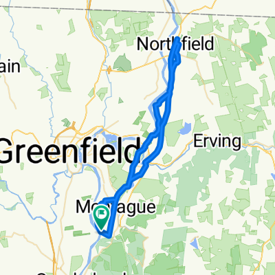
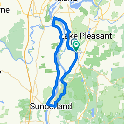
Montague To Northfield and Back
A cycling route starting in Montague, Massachusetts, United States of America.
Overview
About this route
Meadow Rd Montague, Massachusetts to Northfield and back with some variation of route and food and beverage stops along the way.
- -:--
- Duration
- 53.7 km
- Distance
- 266 m
- Ascent
- 266 m
- Descent
- ---
- Avg. speed
- ---
- Avg. speed

Route quality
Waytypes & surfaces along the route
Waytypes
Busy road
25.2 km
(47 %)
Quiet road
21.8 km
(41 %)
Surfaces
Paved
10 km
(19 %)
Unpaved
4.6 km
(9 %)
Asphalt
9.4 km
(18 %)
Unpaved (undefined)
4.6 km
(9 %)
Continue with Bikemap
Use, edit, or download this cycling route
You would like to ride Montague To Northfield and Back or customize it for your own trip? Here is what you can do with this Bikemap route:
Free features
- Save this route as favorite or in collections
- Copy & plan your own version of this route
- Sync your route with Garmin or Wahoo
Premium features
Free trial for 3 days, or one-time payment. More about Bikemap Premium.
- Navigate this route on iOS & Android
- Export a GPX / KML file of this route
- Create your custom printout (try it for free)
- Download this route for offline navigation
Discover more Premium features.
Get Bikemap PremiumFrom our community
Other popular routes starting in Montague
 Montague To Northfield and Back
- Distance
- 53.7 km
- Ascent
- 266 m
- Descent
- 266 m
- Location
- Montague, Massachusetts, United States of America
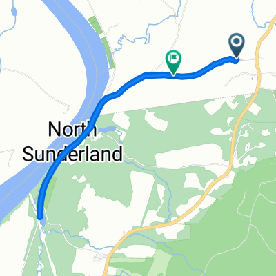
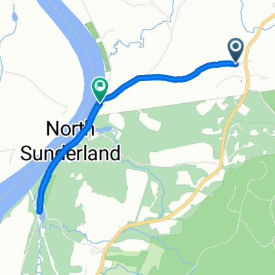
 337–377 Falls Rd, Sunderland to Meadow Rd, Montague
- Distance
- 4.5 km
- Ascent
- 88 m
- Descent
- 81 m
- Location
- Montague, Massachusetts, United States of America
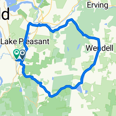 Montague-Wendell 24 loop
- Distance
- 37.1 km
- Ascent
- 395 m
- Descent
- 406 m
- Location
- Montague, Massachusetts, United States of America
 472 Montague Rd, Sunderland to 472 Montague Rd, Sunderland
- Distance
- 15.1 km
- Ascent
- 123 m
- Descent
- 123 m
- Location
- Montague, Massachusetts, United States of America
 266 Greenfield Rd, Montague to 472 Montague Rd, Sunderland
- Distance
- 9 km
- Ascent
- 125 m
- Descent
- 72 m
- Location
- Montague, Massachusetts, United States of America
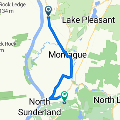
 2 Fosters Rd, Montague to 71–97 Fosters Rd, Sunderland
- Distance
- 4.6 km
- Ascent
- 61 m
- Descent
- 74 m
- Location
- Montague, Massachusetts, United States of America
 Greenfield Rd, Montague to Main St, Montague
- Distance
- 33.4 km
- Ascent
- 414 m
- Descent
- 408 m
- Location
- Montague, Massachusetts, United States of America
 Recovered Route
- Distance
- 3.9 km
- Ascent
- 7 m
- Descent
- 56 m
- Location
- Montague, Massachusetts, United States of America
Open it in the app