

Trip zur Plessenburg
A cycling route starting in Harsleben, Saxony-Anhalt, Germany.
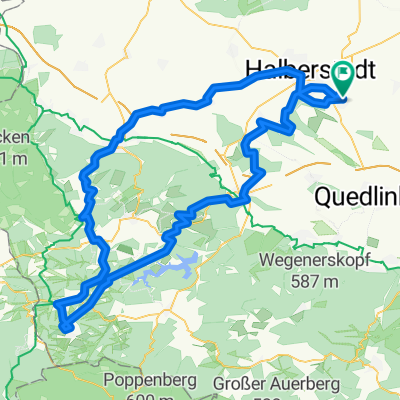
Overview
About this route
Plessenburg bei Ilsenburg einen Besuch abstatten
- -:--
- Duration
- 99.6 km
- Distance
- 687 m
- Ascent
- 686 m
- Descent
- ---
- Avg. speed
- ---
- Avg. speed

Route quality
Waytypes & surfaces along the route
Waytypes
Track
49.7 km
(50 %)
Quiet road
23.6 km
(24 %)
Surfaces
Paved
24.7 km
(25 %)
Unpaved
62.2 km
(62 %)
Gravel
41 km
(41 %)
Asphalt
17.7 km
(18 %)
Route highlights
Points of interest along the route

Point of interest after 24.6 km
Mitbegründer Harzklub

Point of interest after 25 km
"Ebertbrücke" über die Rübelandbahn

Point of interest after 35 km
Erzschacht Büchenberg von 1936-1970

Point of interest after 38.5 km
Hirschbrunnen bei Elbingerode

Point of interest after 51.4 km
Skulptur vor der Plessenburg bei Ilsenburg

Point of interest after 53.8 km
Raststätte am Ilsestein Fr, Sa, So, Ft

Point of interest after 61.9 km
Wasserscheide Elbe-Weser bei Wernigerode

Point of interest after 74.8 km
"Ländergrenze" zw. Braunschweig und Preußen
Continue with Bikemap
Use, edit, or download this cycling route
You would like to ride Trip zur Plessenburg or customize it for your own trip? Here is what you can do with this Bikemap route:
Free features
- Save this route as favorite or in collections
- Copy & plan your own version of this route
- Sync your route with Garmin or Wahoo
Premium features
Free trial for 3 days, or one-time payment. More about Bikemap Premium.
- Navigate this route on iOS & Android
- Export a GPX / KML file of this route
- Create your custom printout (try it for free)
- Download this route for offline navigation
Discover more Premium features.
Get Bikemap PremiumFrom our community
Other popular routes starting in Harsleben
 Brocken und Huy
- Distance
- 150.7 km
- Ascent
- 1,103 m
- Descent
- 1,100 m
- Location
- Harsleben, Saxony-Anhalt, Germany
 Hängebrücke auf Umwegen
- Distance
- 133.2 km
- Ascent
- 858 m
- Descent
- 858 m
- Location
- Harsleben, Saxony-Anhalt, Germany
 Brocken bis Selketal
- Distance
- 167.4 km
- Ascent
- 1,269 m
- Descent
- 1,269 m
- Location
- Harsleben, Saxony-Anhalt, Germany
 Hochwasser-Tour 27.7.17
- Distance
- 47 km
- Ascent
- 102 m
- Descent
- 102 m
- Location
- Harsleben, Saxony-Anhalt, Germany
 Transall - Ballenstedt
- Distance
- 98.1 km
- Ascent
- 577 m
- Descent
- 577 m
- Location
- Harsleben, Saxony-Anhalt, Germany
 Ostharz von Selke bis Bode
- Distance
- 116.6 km
- Ascent
- 913 m
- Descent
- 911 m
- Location
- Harsleben, Saxony-Anhalt, Germany
 Foto-Tour Vorharz
- Distance
- 61.1 km
- Ascent
- 365 m
- Descent
- 366 m
- Location
- Harsleben, Saxony-Anhalt, Germany
 Die Lange
- Distance
- 111.7 km
- Ascent
- 728 m
- Descent
- 727 m
- Location
- Harsleben, Saxony-Anhalt, Germany
Open it in the app