

20170713_101802
A cycling route starting in Wolfenbüttel, Lower Saxony, Germany.
Overview
About this route
TAHUNA track
Saale-Tour Tag 1: Wolfenbüttel an Innerste entlang nach Herzberg (Teil 1)
- -:--
- Duration
- 62.3 km
- Distance
- 447 m
- Ascent
- 104 m
- Descent
- ---
- Avg. speed
- ---
- Avg. speed

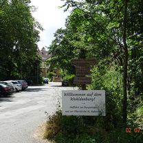
Route photos


Route quality
Waytypes & surfaces along the route
Waytypes
Road
12.7 km
(20 %)
Path
11.3 km
(18 %)
Surfaces
Paved
42.4 km
(68 %)
Unpaved
4.8 km
(8 %)
Asphalt
35.2 km
(56 %)
Paved (undefined)
6.3 km
(10 %)
Continue with Bikemap
Use, edit, or download this cycling route
You would like to ride 20170713_101802 or customize it for your own trip? Here is what you can do with this Bikemap route:
Free features
- Save this route as favorite or in collections
- Copy & plan your own version of this route
- Sync your route with Garmin or Wahoo
Premium features
Free trial for 3 days, or one-time payment. More about Bikemap Premium.
- Navigate this route on iOS & Android
- Export a GPX / KML file of this route
- Create your custom printout (try it for free)
- Download this route for offline navigation
Discover more Premium features.
Get Bikemap PremiumFrom our community
Other popular routes starting in Wolfenbüttel
 20171015_135711.gpx
- Distance
- 75.7 km
- Ascent
- 370 m
- Descent
- 365 m
- Location
- Wolfenbüttel, Lower Saxony, Germany
 20170711_112328.gpx
- Distance
- 98.8 km
- Ascent
- 394 m
- Descent
- 398 m
- Location
- Wolfenbüttel, Lower Saxony, Germany
 sonntagstour 12.7. wf--schladen--wf
- Distance
- 57.2 km
- Ascent
- 241 m
- Descent
- 273 m
- Location
- Wolfenbüttel, Lower Saxony, Germany
 2019 Diemel- und Ruhrtalradtour
- Distance
- 792.2 km
- Ascent
- 4,701 m
- Descent
- 4,703 m
- Location
- Wolfenbüttel, Lower Saxony, Germany
 Elmtour
- Distance
- 86.7 km
- Ascent
- 746 m
- Descent
- 760 m
- Location
- Wolfenbüttel, Lower Saxony, Germany
 Sonntagnachmittag-Verdauungs-Runde
- Distance
- 51 km
- Ascent
- 126 m
- Descent
- 126 m
- Location
- Wolfenbüttel, Lower Saxony, Germany
 Oderwald
- Distance
- 45.1 km
- Ascent
- 193 m
- Descent
- 193 m
- Location
- Wolfenbüttel, Lower Saxony, Germany
 Wolfenbüttel - Adersheim - Leinde - Cramme - Flöthe - Oder - Heiningen
- Distance
- 32.1 km
- Ascent
- 180 m
- Descent
- 179 m
- Location
- Wolfenbüttel, Lower Saxony, Germany
Open it in the app