

MVW - MJT 32k TT
A cycling route starting in Liberty Center, Ohio, United States of America.
Overview
About this route
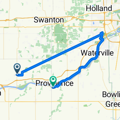
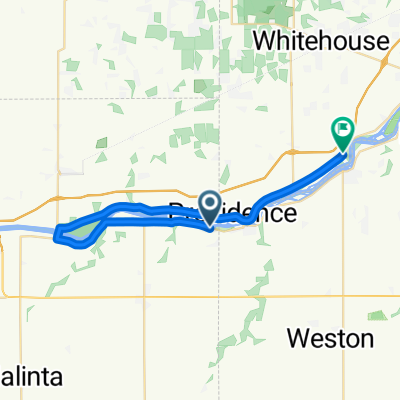
MVW - MJT 32k TT, Grand Rapids, Ohio
Parking at marina area in MJT park
Finish ride and then cool down riding back to bridge crossing and then to park
- -:--
- Duration
- 32 km
- Distance
- 36 m
- Ascent
- 32 m
- Descent
- ---
- Avg. speed
- ---
- Avg. speed
Route quality
Waytypes & surfaces along the route
Waytypes
Busy road
22.3 km
(70 %)
Pedestrian area
4.4 km
(14 %)
Surfaces
Paved
12.7 km
(40 %)
Unpaved
4.7 km
(15 %)
Asphalt
10.1 km
(31 %)
Ground
4.4 km
(14 %)
Continue with Bikemap
Use, edit, or download this cycling route
You would like to ride MVW - MJT 32k TT or customize it for your own trip? Here is what you can do with this Bikemap route:
Free features
- Save this route as favorite or in collections
- Copy & plan your own version of this route
- Sync your route with Garmin or Wahoo
Premium features
Free trial for 3 days, or one-time payment. More about Bikemap Premium.
- Navigate this route on iOS & Android
- Export a GPX / KML file of this route
- Create your custom printout (try it for free)
- Download this route for offline navigation
Discover more Premium features.
Get Bikemap PremiumFrom our community
Other popular routes starting in Liberty Center
 Wild Side
- Distance
- 56.5 km
- Ascent
- 48 m
- Descent
- 59 m
- Location
- Liberty Center, Ohio, United States of America
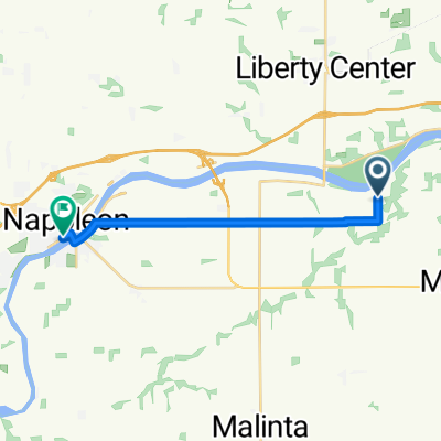 Q101–Q299 Township Road 6B, Napoleon to 255 W Riverview Ave, Napoleon
- Distance
- 13.3 km
- Ascent
- 26 m
- Descent
- 30 m
- Location
- Liberty Center, Ohio, United States of America
 MVW - MJT 32k TT
- Distance
- 32 km
- Ascent
- 36 m
- Descent
- 32 m
- Location
- Liberty Center, Ohio, United States of America
Open it in the app