

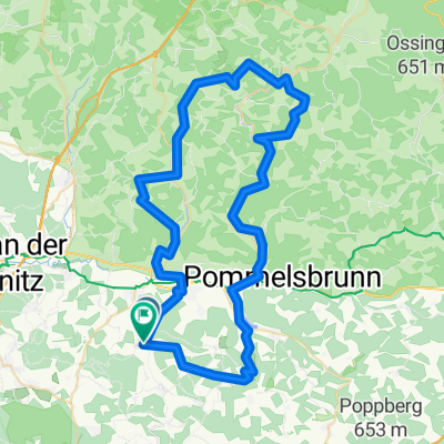
D_Bayern_Engelthal-Offenhausen-Prosberg-Weißenbrunn-Entenberg
A cycling route starting in Engelthal, Bavaria, Germany.
Overview
About this route
Viele Anstiege auf kürzester Strecke
- -:--
- Duration
- 30 km
- Distance
- 785 m
- Ascent
- 790 m
- Descent
- ---
- Avg. speed
- ---
- Avg. speed

Route quality
Waytypes & surfaces along the route
Waytypes
Track
16.5 km
(55 %)
Road
6.3 km
(21 %)
Surfaces
Paved
7.5 km
(25 %)
Unpaved
14.7 km
(49 %)
Gravel
7.8 km
(26 %)
Ground
4.5 km
(15 %)
Continue with Bikemap
Use, edit, or download this cycling route
You would like to ride D_Bayern_Engelthal-Offenhausen-Prosberg-Weißenbrunn-Entenberg or customize it for your own trip? Here is what you can do with this Bikemap route:
Free features
- Save this route as favorite or in collections
- Copy & plan your own version of this route
- Sync your route with Garmin or Wahoo
Premium features
Free trial for 3 days, or one-time payment. More about Bikemap Premium.
- Navigate this route on iOS & Android
- Export a GPX / KML file of this route
- Create your custom printout (try it for free)
- Download this route for offline navigation
Discover more Premium features.
Get Bikemap PremiumFrom our community
Other popular routes starting in Engelthal
 Am Kaiser Karl 8, Engelthal nach Ostbahnstraße 52, Hersbruck
- Distance
- 8.5 km
- Ascent
- 49 m
- Descent
- 94 m
- Location
- Engelthal, Bavaria, Germany
 Engelthal - nördl. Landkreis HEB
- Distance
- 66.8 km
- Ascent
- 787 m
- Descent
- 796 m
- Location
- Engelthal, Bavaria, Germany
 LAU5 32, Engelthal nach LAU5 41, Engelthal
- Distance
- 6.8 km
- Ascent
- 214 m
- Descent
- 216 m
- Location
- Engelthal, Bavaria, Germany
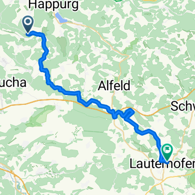
 Deckersberg-Kucha-Fischbach
- Distance
- 33.7 km
- Ascent
- 242 m
- Descent
- 443 m
- Location
- Engelthal, Bavaria, Germany
 weißes Lamm über Henfenfeld
- Distance
- 8.8 km
- Ascent
- 31 m
- Descent
- 62 m
- Location
- Engelthal, Bavaria, Germany
 Deckersberg Rückweg
- Distance
- 24.6 km
- Ascent
- 304 m
- Descent
- 350 m
- Location
- Engelthal, Bavaria, Germany
 Steigung Engelthal-Deckersberg
- Distance
- 5.3 km
- Ascent
- 202 m
- Descent
- 25 m
- Location
- Engelthal, Bavaria, Germany
 ÄL¥?? nach ÄL¥??
- Distance
- 43.4 km
- Ascent
- 90 m
- Descent
- 140 m
- Location
- Engelthal, Bavaria, Germany
Open it in the app