

Burgund 2017 Route 3
A cycling route starting in La Pacaudière, Auvergne-Rhône-Alpes, France.
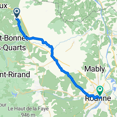
Overview
About this route
- -:--
- Duration
- 80 km
- Distance
- 363 m
- Ascent
- 404 m
- Descent
- ---
- Avg. speed
- ---
- Avg. speed
Route quality
Waytypes & surfaces along the route
Waytypes
Road
32.1 km
(40 %)
Quiet road
21 km
(26 %)
Surfaces
Paved
22.8 km
(29 %)
Unpaved
3.1 km
(4 %)
Asphalt
22.8 km
(29 %)
Ground
3.1 km
(4 %)
Undefined
54.1 km
(68 %)
Continue with Bikemap
Use, edit, or download this cycling route
You would like to ride Burgund 2017 Route 3 or customize it for your own trip? Here is what you can do with this Bikemap route:
Free features
- Save this route as favorite or in collections
- Copy & plan your own version of this route
- Sync your route with Garmin or Wahoo
Premium features
Free trial for 3 days, or one-time payment. More about Bikemap Premium.
- Navigate this route on iOS & Android
- Export a GPX / KML file of this route
- Create your custom printout (try it for free)
- Download this route for offline navigation
Discover more Premium features.
Get Bikemap PremiumFrom our community
Other popular routes starting in La Pacaudière
 18-MassifCentral
- Distance
- 70.6 km
- Ascent
- 494 m
- Descent
- 506 m
- Location
- La Pacaudière, Auvergne-Rhône-Alpes, France
 De Route de Saint-Germain, Saint-Forgeux-Lespinasse à Route de Saint-Germain, Saint-Forgeux-Lespinasse
- Distance
- 3.2 km
- Ascent
- 35 m
- Descent
- 32 m
- Location
- La Pacaudière, Auvergne-Rhône-Alpes, France
 Recovered Route
- Distance
- 10.8 km
- Ascent
- 67 m
- Descent
- 62 m
- Location
- La Pacaudière, Auvergne-Rhône-Alpes, France
 De 28–58 Place du Petit Louvre, La Pacaudière à 7 Rue de Bourgogne, Roanne
- Distance
- 26.8 km
- Ascent
- 172 m
- Descent
- 245 m
- Location
- La Pacaudière, Auvergne-Rhône-Alpes, France
 Parcours Benjamins 3
- Distance
- 30.8 km
- Ascent
- 367 m
- Descent
- 365 m
- Location
- La Pacaudière, Auvergne-Rhône-Alpes, France
 Parcours pupilles 3
- Distance
- 18.6 km
- Ascent
- 155 m
- Descent
- 155 m
- Location
- La Pacaudière, Auvergne-Rhône-Alpes, France
 Parcours Poussins 4
- Distance
- 15.2 km
- Ascent
- 86 m
- Descent
- 83 m
- Location
- La Pacaudière, Auvergne-Rhône-Alpes, France
 De 141–201 Place du Champ de Foire, Changy à Route de Saint-Germain, Saint-Forgeux-Lespinasse
- Distance
- 6.9 km
- Ascent
- 22 m
- Descent
- 50 m
- Location
- La Pacaudière, Auvergne-Rhône-Alpes, France
Open it in the app