

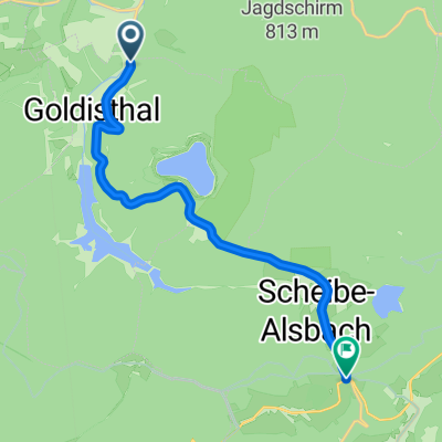
Talsperre Goldisthal-Rundweg
A cycling route starting in Goldisthal, Free State of Thuringia, Germany.
Overview
About this route
- -:--
- Duration
- 19.8 km
- Distance
- 628 m
- Ascent
- 618 m
- Descent
- ---
- Avg. speed
- ---
- Avg. speed

Route quality
Waytypes & surfaces along the route
Waytypes
Track
9 km
(45 %)
Quiet road
3.1 km
(16 %)
Surfaces
Paved
2.8 km
(14 %)
Unpaved
13.1 km
(66 %)
Gravel
9.5 km
(48 %)
Ground
3.5 km
(18 %)
Continue with Bikemap
Use, edit, or download this cycling route
You would like to ride Talsperre Goldisthal-Rundweg or customize it for your own trip? Here is what you can do with this Bikemap route:
Free features
- Save this route as favorite or in collections
- Copy & plan your own version of this route
- Sync your route with Garmin or Wahoo
Premium features
Free trial for 3 days, or one-time payment. More about Bikemap Premium.
- Navigate this route on iOS & Android
- Export a GPX / KML file of this route
- Create your custom printout (try it for free)
- Download this route for offline navigation
Discover more Premium features.
Get Bikemap PremiumFrom our community
Other popular routes starting in Goldisthal
 Wurzelberg
- Distance
- 8.5 km
- Ascent
- 277 m
- Descent
- 277 m
- Location
- Goldisthal, Free State of Thuringia, Germany
 Tour 22.04.2017
- Distance
- 20.9 km
- Ascent
- 350 m
- Descent
- 344 m
- Location
- Goldisthal, Free State of Thuringia, Germany
 Bergzeifahren Thüringen Trainingslager
- Distance
- 9.8 km
- Ascent
- 434 m
- Descent
- 209 m
- Location
- Goldisthal, Free State of Thuringia, Germany
 1.2.1. Skitour Friedrichshöhe-Neuhaus/Rennweg
- Distance
- 11 km
- Ascent
- 152 m
- Descent
- 143 m
- Location
- Goldisthal, Free State of Thuringia, Germany
 Langlauf 15.02.2015
- Distance
- 17.4 km
- Ascent
- 242 m
- Descent
- 243 m
- Location
- Goldisthal, Free State of Thuringia, Germany
 Goldisthal 2
- Distance
- 24.9 km
- Ascent
- 687 m
- Descent
- 660 m
- Location
- Goldisthal, Free State of Thuringia, Germany
 20150418_093854.gpx
- Distance
- 22.4 km
- Ascent
- 358 m
- Descent
- 355 m
- Location
- Goldisthal, Free State of Thuringia, Germany
 Friedrichshöhe - Werraquell Hütte
- Distance
- 5.2 km
- Ascent
- 61 m
- Descent
- 65 m
- Location
- Goldisthal, Free State of Thuringia, Germany
Open it in the app