

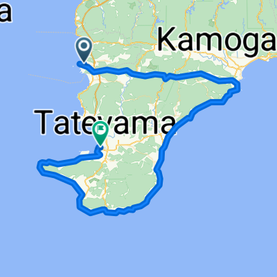
BR-CCT-Miyoshi-Circuit
A cycling route starting in Tateyama, Chiba, Japan.
Overview
About this route
- -:--
- Duration
- 20.7 km
- Distance
- 236 m
- Ascent
- 234 m
- Descent
- ---
- Avg. speed
- ---
- Avg. speed

Continue with Bikemap
Use, edit, or download this cycling route
You would like to ride BR-CCT-Miyoshi-Circuit or customize it for your own trip? Here is what you can do with this Bikemap route:
Free features
- Save this route as favorite or in collections
- Copy & plan your own version of this route
- Sync your route with Garmin or Wahoo
Premium features
Free trial for 3 days, or one-time payment. More about Bikemap Premium.
- Navigate this route on iOS & Android
- Export a GPX / KML file of this route
- Create your custom printout (try it for free)
- Download this route for offline navigation
Discover more Premium features.
Get Bikemap PremiumFrom our community
Other popular routes starting in Tateyama
 Hota-Mineoka-Chikura-Tateyama
- Distance
- 101.8 km
- Ascent
- 586 m
- Descent
- 592 m
- Location
- Tateyama, Chiba, Japan
 Uchibo from Tomiura to Chibo
- Distance
- 49.3 km
- Ascent
- 120 m
- Descent
- 121 m
- Location
- Tateyama, Chiba, Japan
 Minami Boso Loop
- Distance
- 58.9 km
- Ascent
- 176 m
- Descent
- 176 m
- Location
- Tateyama, Chiba, Japan
 Awakatsuyama-Awakamogawa-Chikura-Tateyama
- Distance
- 95.2 km
- Ascent
- 299 m
- Descent
- 298 m
- Location
- Tateyama, Chiba, Japan
 Boso S3: Chikura - Hatake - Shirahama
- Distance
- 11.2 km
- Ascent
- 247 m
- Descent
- 245 m
- Location
- Tateyama, Chiba, Japan
 20210919 南房総
- Distance
- 61.8 km
- Ascent
- 264 m
- Descent
- 261 m
- Location
- Tateyama, Chiba, Japan
 BAC-Chikura-Wadaura
- Distance
- 11.5 km
- Ascent
- 66 m
- Descent
- 79 m
- Location
- Tateyama, Chiba, Japan
 0526N
0526N- Distance
- 37.5 km
- Ascent
- 244 m
- Descent
- 246 m
- Location
- Tateyama, Chiba, Japan
Open it in the app