
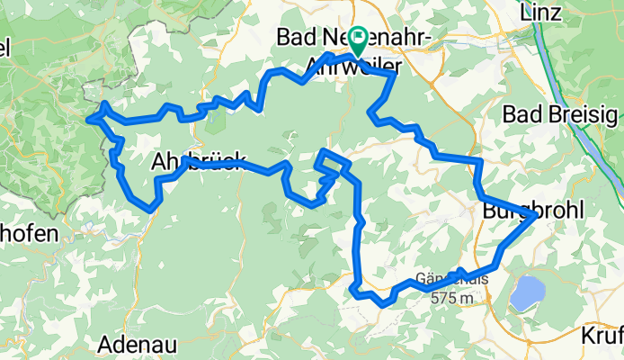
RTF Sturmvogel Bad Neuenahr 107KM 1550hm
A cycling route starting in Bad Neuenahr-Ahrweiler, Rhineland-Palatinate, Germany.
Overview
About this route
- -:--
- Duration
- 107.5 km
- Distance
- 1,181 m
- Ascent
- 1,181 m
- Descent
- ---
- Avg. speed
- ---
- Avg. speed

Route quality
Waytypes & surfaces along the route
Waytypes
Busy road
79.7 km
(74 %)
Road
11.4 km
(11 %)
Surfaces
Paved
92.1 km
(86 %)
Unpaved
1.4 km
(1 %)
Asphalt
91.6 km
(85 %)
Ground
1.1 km
(<1 %)
Continue with Bikemap
Use, edit, or download this cycling route
You would like to ride RTF Sturmvogel Bad Neuenahr 107KM 1550hm or customize it for your own trip? Here is what you can do with this Bikemap route:
Free features
- Save this route as favorite or in collections
- Copy & plan your own version of this route
- Sync your route with Garmin or Wahoo
Premium features
Free trial for 3 days, or one-time payment. More about Bikemap Premium.
- Navigate this route on iOS & Android
- Export a GPX / KML file of this route
- Create your custom printout (try it for free)
- Download this route for offline navigation
Discover more Premium features.
Get Bikemap PremiumFrom our community
Other popular routes starting in Bad Neuenahr-Ahrweiler
 Heerstraße 129C, Bad Neuenahr-Ahrweiler nach Heerstraße 129C, Bad Neuenahr-Ahrweiler
- Distance
- 27.1 km
- Ascent
- 314 m
- Descent
- 314 m
- Location
- Bad Neuenahr-Ahrweiler, Rhineland-Palatinate, Germany
 Rund um Ahrweiler
- Distance
- 14.6 km
- Ascent
- 317 m
- Descent
- 318 m
- Location
- Bad Neuenahr-Ahrweiler, Rhineland-Palatinate, Germany
 Katzley - Bunte Kuh
- Distance
- 18.2 km
- Ascent
- 417 m
- Descent
- 417 m
- Location
- Bad Neuenahr-Ahrweiler, Rhineland-Palatinate, Germany
 Lust und Genuß im Ahrtal 2012 - RTF des Radsportverein Sturmvogel Bad Neuenahr-Ahrweiler 1890 e.V. - 74 km Strecke
- Distance
- 76.3 km
- Ascent
- 818 m
- Descent
- 818 m
- Location
- Bad Neuenahr-Ahrweiler, Rhineland-Palatinate, Germany
 Ahrtal II
- Distance
- 40.6 km
- Ascent
- 723 m
- Descent
- 710 m
- Location
- Bad Neuenahr-Ahrweiler, Rhineland-Palatinate, Germany
 Stammtischroute Ahrtal
- Distance
- 35.4 km
- Ascent
- 216 m
- Descent
- 218 m
- Location
- Bad Neuenahr-Ahrweiler, Rhineland-Palatinate, Germany
 2 Ahrweiler - Kobern - Gondorf
- Distance
- 64.6 km
- Ascent
- 98 m
- Descent
- 127 m
- Location
- Bad Neuenahr-Ahrweiler, Rhineland-Palatinate, Germany
 From Bad Neuenahr-Ahrweiler to Blankenheim
- Distance
- 75 km
- Ascent
- 1,156 m
- Descent
- 786 m
- Location
- Bad Neuenahr-Ahrweiler, Rhineland-Palatinate, Germany
Open it in the app