

Obersdorf - Mistelbach - Laa an der Thaya
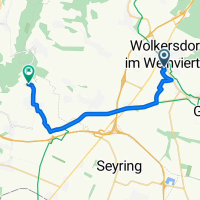
A cycling route starting in Wolkersdorf im Weinviertel, Lower Austria, Austria.
Overview
About this route
- 4 h 9 min
- Duration
- 62.6 km
- Distance
- 229 m
- Ascent
- 216 m
- Descent
- 15.1 km/h
- Avg. speed
- ---
- Avg. speed

Route quality
Waytypes & surfaces along the route
Waytypes
Quiet road
25.2 km
(40 %)
Track
15.8 km
(25 %)
Surfaces
Paved
43.8 km
(70 %)
Unpaved
2.7 km
(4 %)
Asphalt
39.5 km
(63 %)
Paved (undefined)
4.1 km
(7 %)
Continue with Bikemap
Use, edit, or download this cycling route
You would like to ride Obersdorf - Mistelbach - Laa an der Thaya or customize it for your own trip? Here is what you can do with this Bikemap route:
Free features
- Save this route as favorite or in collections
- Copy & plan your own version of this route
- Sync your route with Garmin or Wahoo
Premium features
Free trial for 3 days, or one-time payment. More about Bikemap Premium.
- Navigate this route on iOS & Android
- Export a GPX / KML file of this route
- Create your custom printout (try it for free)
- Download this route for offline navigation
Discover more Premium features.
Get Bikemap PremiumFrom our community
Other popular routes starting in Wolkersdorf im Weinviertel
 Windischhütte über Kahlenberg
- Distance
- 83.6 km
- Ascent
- 1,153 m
- Descent
- 1,150 m
- Location
- Wolkersdorf im Weinviertel, Lower Austria, Austria
 Energie graveln. Sunny Side.
- Distance
- 16.7 km
- Ascent
- 117 m
- Descent
- 182 m
- Location
- Wolkersdorf im Weinviertel, Lower Austria, Austria
 Kahlenberg + Buschberg
- Distance
- 119.1 km
- Ascent
- 1,454 m
- Descent
- 1,446 m
- Location
- Wolkersdorf im Weinviertel, Lower Austria, Austria
 Kühltal nach Neustiftkeller Enzersfeld
- Distance
- 11.9 km
- Ascent
- 73 m
- Descent
- 23 m
- Location
- Wolkersdorf im Weinviertel, Lower Austria, Austria
 Radrunde durch Gemeinde Wolkersdorf im Weinviertel
- Distance
- 28.7 km
- Ascent
- 45 m
- Descent
- 43 m
- Location
- Wolkersdorf im Weinviertel, Lower Austria, Austria
 Weinradroute - Zweigelt
- Distance
- 74.7 km
- Ascent
- 676 m
- Descent
- 679 m
- Location
- Wolkersdorf im Weinviertel, Lower Austria, Austria
 Korneuburg
- Distance
- 51.6 km
- Ascent
- 120 m
- Descent
- 120 m
- Location
- Wolkersdorf im Weinviertel, Lower Austria, Austria
 Autumnable Gravel mit Wieneinfahrt.
- Distance
- 50.3 km
- Ascent
- 316 m
- Descent
- 404 m
- Location
- Wolkersdorf im Weinviertel, Lower Austria, Austria
Open it in the app