
Macchia della Magona 1
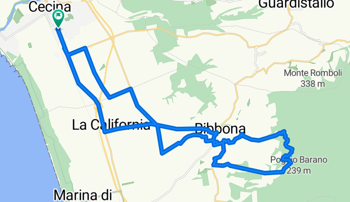
A cycling route starting in Cecina, Tuscany, Italy.
Overview
About this route
Percorso di facile percorrenza adatto che si dirige alle soglie della Macchia della Magona fino al punto panoramico prossimo a loc. La Casetta.
- -:--
- Duration
- 29.6 km
- Distance
- 255 m
- Ascent
- 255 m
- Descent
- ---
- Avg. speed
- ---
- Avg. speed

Route quality
Waytypes & surfaces along the route
Waytypes
Busy road
9.4 km
(32 %)
Quiet road
8.9 km
(30 %)
Surfaces
Paved
17.4 km
(59 %)
Unpaved
9.5 km
(32 %)
Asphalt
17.4 km
(59 %)
Gravel
3.9 km
(13 %)
Continue with Bikemap
Use, edit, or download this cycling route
You would like to ride Macchia della Magona 1 or customize it for your own trip? Here is what you can do with this Bikemap route:
Free features
- Save this route as favorite or in collections
- Copy & plan your own version of this route
- Sync your route with Garmin or Wahoo
Premium features
Free trial for 3 days, or one-time payment. More about Bikemap Premium.
- Navigate this route on iOS & Android
- Export a GPX / KML file of this route
- Create your custom printout (try it for free)
- Download this route for offline navigation
Discover more Premium features.
Get Bikemap PremiumFrom our community
Other popular routes starting in Cecina
 Toskana 5. Fahrt
- Distance
- 107.4 km
- Ascent
- 2,269 m
- Descent
- 2,076 m
- Location
- Cecina, Tuscany, Italy
 Toskana 4. Fahrt
- Distance
- 78 km
- Ascent
- 1,605 m
- Descent
- 1,439 m
- Location
- Cecina, Tuscany, Italy
 1° giorno Cecina- Sassetta
- Distance
- 44.2 km
- Ascent
- 513 m
- Descent
- 342 m
- Location
- Cecina, Tuscany, Italy
 Giro del Monte Vaso
- Distance
- 36.7 km
- Ascent
- 689 m
- Descent
- 358 m
- Location
- Cecina, Tuscany, Italy
 Vada Coast 1
- Distance
- 18.2 km
- Ascent
- 48 m
- Descent
- 49 m
- Location
- Cecina, Tuscany, Italy
 CECINA TOUR
- Distance
- 11.4 km
- Ascent
- 48 m
- Descent
- 46 m
- Location
- Cecina, Tuscany, Italy
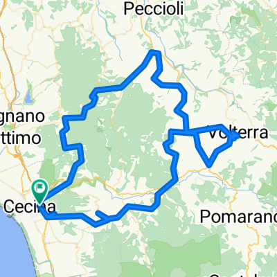 La Val di Cecina
- Distance
- 124.3 km
- Ascent
- 2,262 m
- Descent
- 2,144 m
- Location
- Cecina, Tuscany, Italy
 140km Runde Toscana
- Distance
- 139.8 km
- Ascent
- 2,507 m
- Descent
- 2,471 m
- Location
- Cecina, Tuscany, Italy
Open it in the app