

Vetzan Trail Runde S2
A cycling route starting in Latsch, Trentino-Alto Adige, Italy.
Overview
About this route
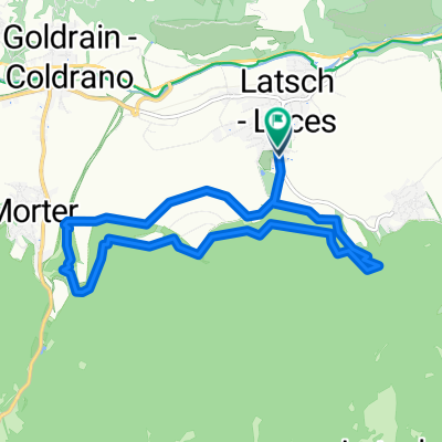
Von Latsch über die Obstgärten bis nach Vetzan. Dann hoch bis ca. 1050 Meter. Nun beginnt schon das erst Trailvergnügen über verschiedene Trails die dann bis oberhalb von Vetzan gehen. Über eine Schotterstraße bikenwieder bergauf bis zum Schloss Annaberg. Hier gibt es nun mehrere Trailvarianten als Abfahrt bis nach Goldrain. Dann nach Morter und zurück nach Latsch.
- -:--
- Duration
- 27.1 km
- Distance
- 980 m
- Ascent
- 978 m
- Descent
- ---
- Avg. speed
- ---
- Avg. speed

Continue with Bikemap
Use, edit, or download this cycling route
You would like to ride Vetzan Trail Runde S2 or customize it for your own trip? Here is what you can do with this Bikemap route:
Free features
- Save this route as favorite or in collections
- Copy & plan your own version of this route
- Sync your route with Garmin or Wahoo
Premium features
Free trial for 3 days, or one-time payment. More about Bikemap Premium.
- Navigate this route on iOS & Android
- Export a GPX / KML file of this route
- Create your custom printout (try it for free)
- Download this route for offline navigation
Discover more Premium features.
Get Bikemap PremiumFrom our community
Other popular routes starting in Latsch
 Latscher Trail Zauber S2 (klein)
- Distance
- 11.1 km
- Ascent
- 388 m
- Descent
- 394 m
- Location
- Latsch, Trentino-Alto Adige, Italy
 Uphill Schloss-Annenberg
- Distance
- 13.8 km
- Ascent
- 1,125 m
- Descent
- 34 m
- Location
- Latsch, Trentino-Alto Adige, Italy
 LatscherAlm-TarscherAlm-MarzonerAlm Tour S2
- Distance
- 48.7 km
- Ascent
- 2,023 m
- Descent
- 2,024 m
- Location
- Latsch, Trentino-Alto Adige, Italy
 Martelltal bis zum Stausee
- Distance
- 48.9 km
- Ascent
- 1,551 m
- Descent
- 1,542 m
- Location
- Latsch, Trentino-Alto Adige, Italy
 Latscher Trail Zauber S2 (gross)
- Distance
- 15.8 km
- Ascent
- 552 m
- Descent
- 553 m
- Location
- Latsch, Trentino-Alto Adige, Italy
 über die Bärenböden
- Distance
- 28.5 km
- Ascent
- 1,098 m
- Descent
- 1,098 m
- Location
- Latsch, Trentino-Alto Adige, Italy
 Goldrain - Ruine Schloss Montani - Trimdichpfad Latsch - Radweg / St. Martin Seilbahn ;)
- Distance
- 11.9 km
- Ascent
- 1,885 m
- Descent
- 1,953 m
- Location
- Latsch, Trentino-Alto Adige, Italy
 Vinschgau 05 (Haslhof)
- Distance
- 28.6 km
- Ascent
- 1,284 m
- Descent
- 1,284 m
- Location
- Latsch, Trentino-Alto Adige, Italy
Open it in the app