

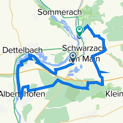
Nürnberg - Koblenz Etappe 5/13
A cycling route starting in Dettelbach, Bavaria, Germany.
Overview
About this route
13 Etappen entlang von Main und Rhein
- -:--
- Duration
- 47.7 km
- Distance
- 62 m
- Ascent
- 95 m
- Descent
- ---
- Avg. speed
- ---
- Avg. speed

Route quality
Waytypes & surfaces along the route
Waytypes
Path
20.5 km
(43 %)
Quiet road
6.9 km
(14 %)
Surfaces
Paved
44.8 km
(94 %)
Asphalt
42.5 km
(89 %)
Paving stones
1.9 km
(4 %)
Continue with Bikemap
Use, edit, or download this cycling route
You would like to ride Nürnberg - Koblenz Etappe 5/13 or customize it for your own trip? Here is what you can do with this Bikemap route:
Free features
- Save this route as favorite or in collections
- Copy & plan your own version of this route
- Sync your route with Garmin or Wahoo
Premium features
Free trial for 3 days, or one-time payment. More about Bikemap Premium.
- Navigate this route on iOS & Android
- Export a GPX / KML file of this route
- Create your custom printout (try it for free)
- Download this route for offline navigation
Discover more Premium features.
Get Bikemap PremiumFrom our community
Other popular routes starting in Dettelbach
 Dettelb- Route 1 kurz
- Distance
- 17.1 km
- Ascent
- 194 m
- Descent
- 195 m
- Location
- Dettelbach, Bavaria, Germany
 17-4DETTELBACH-GEMÜNDEN
- Distance
- 87.5 km
- Ascent
- 83 m
- Descent
- 119 m
- Location
- Dettelbach, Bavaria, Germany
 Dettelbach - Retzstadt
- Distance
- 70.9 km
- Ascent
- 109 m
- Descent
- 73 m
- Location
- Dettelbach, Bavaria, Germany
 B22, Schwarzach am Main nach Schweinfurter Straße 97, Schwarzach am Main
- Distance
- 25.8 km
- Ascent
- 100 m
- Descent
- 96 m
- Location
- Dettelbach, Bavaria, Germany
 Genießer-Tour (Tour 2) - Genießer-Tour (Tour 2)
- Distance
- 41 km
- Ascent
- 228 m
- Descent
- 226 m
- Location
- Dettelbach, Bavaria, Germany
 Etappe_06_bike
- Distance
- 46.2 km
- Ascent
- 70 m
- Descent
- 106 m
- Location
- Dettelbach, Bavaria, Germany
 Tag 5 Mainradweg Dettelbach
- Distance
- 9.3 km
- Ascent
- 71 m
- Descent
- 74 m
- Location
- Dettelbach, Bavaria, Germany
 Dettelbach in den Steigerwald
- Distance
- 67.5 km
- Ascent
- 767 m
- Descent
- 754 m
- Location
- Dettelbach, Bavaria, Germany
Open it in the app