

Garmisch- Osterfelderkopf-Reintalangerhütte
A cycling route starting in Garmisch-Partenkirchen, Bavaria, Germany.
Overview
About this route
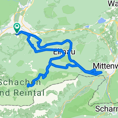
Vom Garmisch zur Hochalm um den Osterfelderkopf, Bernadeinsteig und dann zur Reintalangerhütte und zurück nach Garmisch.
- -:--
- Duration
- 55.1 km
- Distance
- 1,751 m
- Ascent
- 1,751 m
- Descent
- ---
- Avg. speed
- ---
- Avg. speed

Route highlights
Points of interest along the route
Point of interest after 38 km
Reintalangerhütte
Continue with Bikemap
Use, edit, or download this cycling route
You would like to ride Garmisch- Osterfelderkopf-Reintalangerhütte or customize it for your own trip? Here is what you can do with this Bikemap route:
Free features
- Save this route as favorite or in collections
- Copy & plan your own version of this route
- Sync your route with Garmin or Wahoo
Premium features
Free trial for 3 days, or one-time payment. More about Bikemap Premium.
- Navigate this route on iOS & Android
- Export a GPX / KML file of this route
- Create your custom printout (try it for free)
- Download this route for offline navigation
Discover more Premium features.
Get Bikemap PremiumFrom our community
Other popular routes starting in Garmisch-Partenkirchen
 Garmisch-Lautersee-Schachenhaus
- Distance
- 54.7 km
- Ascent
- 1,601 m
- Descent
- 1,598 m
- Location
- Garmisch-Partenkirchen, Bavaria, Germany
 Hausfrauenrunde Garmisch-Riva
- Distance
- 362.1 km
- Ascent
- 4,050 m
- Descent
- 4,691 m
- Location
- Garmisch-Partenkirchen, Bavaria, Germany
 Zugspitztour Tag 1
- Distance
- 33.6 km
- Ascent
- 1,470 m
- Descent
- 673 m
- Location
- Garmisch-Partenkirchen, Bavaria, Germany
 Rundtour Wettersteingebirge
- Distance
- 157.6 km
- Ascent
- 3,314 m
- Descent
- 3,310 m
- Location
- Garmisch-Partenkirchen, Bavaria, Germany
 Von Garmisch zum Schachen
- Distance
- 44.7 km
- Ascent
- 1,559 m
- Descent
- 1,556 m
- Location
- Garmisch-Partenkirchen, Bavaria, Germany
 Stepbergtrail - Garmisch
- Distance
- 26 km
- Ascent
- 1,183 m
- Descent
- 1,183 m
- Location
- Garmisch-Partenkirchen, Bavaria, Germany
 Garmisch Gardasee
- Distance
- 339.8 km
- Ascent
- 1,961 m
- Descent
- 2,586 m
- Location
- Garmisch-Partenkirchen, Bavaria, Germany
 Von Garmisch bis Schuls
- Distance
- 147.2 km
- Ascent
- 3,880 m
- Descent
- 3,375 m
- Location
- Garmisch-Partenkirchen, Bavaria, Germany
Open it in the app