

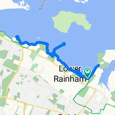
Riverside Country park Gillingham Kent
A cycling route starting in Rainham, England, United Kingdom.
Overview
About this route
Starting at Riverside Country Park side of Car Park along Horrid Hill and back left along river to Motney Hill and back to Riverside Country Park
- -:--
- Duration
- 12.3 km
- Distance
- 13 m
- Ascent
- 14 m
- Descent
- ---
- Avg. speed
- ---
- Avg. speed

Route quality
Waytypes & surfaces along the route
Waytypes
Cycleway
8.7 km
(71 %)
Quiet road
1.8 km
(15 %)
Surfaces
Unpaved
7.9 km
(64 %)
Gravel
7.8 km
(64 %)
Ground
0 km
(<1 %)
Undefined
4.4 km
(36 %)
Continue with Bikemap
Use, edit, or download this cycling route
You would like to ride Riverside Country park Gillingham Kent or customize it for your own trip? Here is what you can do with this Bikemap route:
Free features
- Save this route as favorite or in collections
- Copy & plan your own version of this route
- Sync your route with Garmin or Wahoo
Premium features
Free trial for 3 days, or one-time payment. More about Bikemap Premium.
- Navigate this route on iOS & Android
- Export a GPX / KML file of this route
- Create your custom printout (try it for free)
- Download this route for offline navigation
Discover more Premium features.
Get Bikemap PremiumFrom our community
Other popular routes starting in Rainham
 Headcorn-Charing
- Distance
- 85.4 km
- Ascent
- 631 m
- Descent
- 655 m
- Location
- Rainham, England, United Kingdom
 Bxl - Londres J5 : Rainham - Rochester - Nortfleet - Greenwich
- Distance
- 76.6 km
- Ascent
- 210 m
- Descent
- 219 m
- Location
- Rainham, England, United Kingdom
 Moderate route in Gillingham
- Distance
- 11.3 km
- Ascent
- 0 m
- Descent
- 3 m
- Location
- Rainham, England, United Kingdom
 mmmmmmm
- Distance
- 308.2 km
- Ascent
- 162 m
- Descent
- 14 m
- Location
- Rainham, England, United Kingdom
 Local
Local- Distance
- 36.5 km
- Ascent
- 292 m
- Descent
- 296 m
- Location
- Rainham, England, United Kingdom
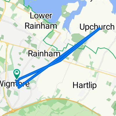 Brief ride through upchurch
- Distance
- 11.4 km
- Ascent
- 108 m
- Descent
- 109 m
- Location
- Rainham, England, United Kingdom
 Day 1
Day 1- Distance
- 150.2 km
- Ascent
- 735 m
- Descent
- 782 m
- Location
- Rainham, England, United Kingdom
 Burrstock Way 46, Rainham to Burrstock Way 66, Rainham
- Distance
- 5.2 km
- Ascent
- 39 m
- Descent
- 34 m
- Location
- Rainham, England, United Kingdom
Open it in the app