

Garmisch-Kranzberg-Lautersee
A cycling route starting in Garmisch-Partenkirchen, Bavaria, Germany.
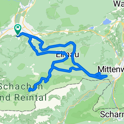
Overview
About this route
Bei der St. Anton Hütte ist der Barfussweg Mittenwald. Nach der Lautersee Stubn noch einen kleinen Trail Abstecher.
- -:--
- Duration
- 49.2 km
- Distance
- 1,443 m
- Ascent
- 1,442 m
- Descent
- ---
- Avg. speed
- ---
- Avg. speed

Route highlights
Points of interest along the route

Point of interest after 18.9 km
Kranzberg Haus

Point of interest after 22.9 km
St. Anton Hütte

Point of interest after 23 km
BarfussPfad Mittenwald

Point of interest after 24.9 km
Lautersee Stubn

Point of interest after 26.9 km
FerchenseeTrail

Point of interest after 31.4 km
Gasthof Ferchensee
Continue with Bikemap
Use, edit, or download this cycling route
You would like to ride Garmisch-Kranzberg-Lautersee or customize it for your own trip? Here is what you can do with this Bikemap route:
Free features
- Save this route as favorite or in collections
- Copy & plan your own version of this route
- Sync your route with Garmin or Wahoo
Premium features
Free trial for 3 days, or one-time payment. More about Bikemap Premium.
- Navigate this route on iOS & Android
- Export a GPX / KML file of this route
- Create your custom printout (try it for free)
- Download this route for offline navigation
Discover more Premium features.
Get Bikemap PremiumFrom our community
Other popular routes starting in Garmisch-Partenkirchen
 Von Garmisch zum Schachen
- Distance
- 44.7 km
- Ascent
- 1,559 m
- Descent
- 1,556 m
- Location
- Garmisch-Partenkirchen, Bavaria, Germany
 Garmisch Gardasee
- Distance
- 339.8 km
- Ascent
- 1,961 m
- Descent
- 2,586 m
- Location
- Garmisch-Partenkirchen, Bavaria, Germany
 Via Claudia Augusta und München Venedig
- Distance
- 586.8 km
- Ascent
- 10,373 m
- Descent
- 10,552 m
- Location
- Garmisch-Partenkirchen, Bavaria, Germany
 Alpencross Einsteiger
- Distance
- 331.6 km
- Ascent
- 1,900 m
- Descent
- 2,522 m
- Location
- Garmisch-Partenkirchen, Bavaria, Germany
 Garmisch-Lautersee-Schachenhaus
- Distance
- 54.7 km
- Ascent
- 1,601 m
- Descent
- 1,598 m
- Location
- Garmisch-Partenkirchen, Bavaria, Germany
 Partenkirchen - Kreuzjoch - partnachklamm - Emau - Partenkirchen
- Distance
- 45.1 km
- Ascent
- 1,321 m
- Descent
- 1,321 m
- Location
- Garmisch-Partenkirchen, Bavaria, Germany
 Zugspitztour Tag 1
- Distance
- 33.6 km
- Ascent
- 1,470 m
- Descent
- 673 m
- Location
- Garmisch-Partenkirchen, Bavaria, Germany
 Rundtour Wettersteingebirge
- Distance
- 157.6 km
- Ascent
- 3,314 m
- Descent
- 3,310 m
- Location
- Garmisch-Partenkirchen, Bavaria, Germany
Open it in the app