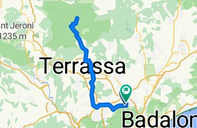
Cycling Route in Cerdanyola del Vallès, Catalonia, Spain
Ruta13Coll D'Estenalles

Open this route in the Bikemap app

Open this route in Bikemap Web
Distance
Ascent
Descent
Duration
Avg. Speed
Max. Elevation
Cycling Route in Cerdanyola del Vallès, Catalonia, Spain

Open this route in the Bikemap app

Open this route in Bikemap Web
Ruta que ens portarà cap el Parc Natural de l’Obac concretament fins el Coll d’Estenalles. Travessarem les poblacions de Rubí i Terrassa per agafar la carretera de Matadepera, és llavors quan aquesta s’enfila poc a poc. La pujada final d’uns 12 kilòmetres, no és una pujada massa forta, però si bastant llarga, la pendent té un 4% de mitjana, a excepció d’algun tram que sí que ens obligarà a esforçar-nos de valent. La tornada pel mateix itinerari és molt ràpida.
PROMIG TEMPS A 29km/h2h24m 26km/h2h41m 24km/h2h55m

Did you know? You can use this route as a template in our cycling route planner if you don't wish to start from scratch. Customize it based on your needs to plan your perfect cycling tour.
Open it in the app