

Northern Cross-Island Highway (YingGe-QiLan)
A cycling route starting in Taoyuan District, Taiwan, Taiwan.
Overview
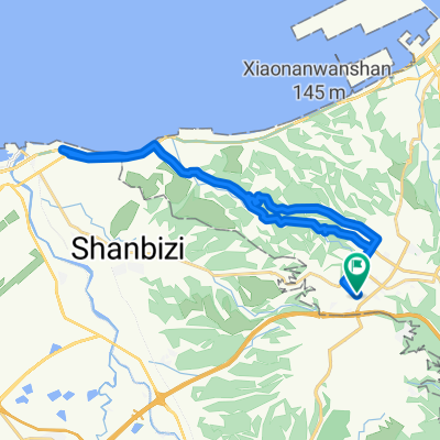
About this route
TR-7, start from YingGe, end to QiLan
- -:--
- Duration
- 96.4 km
- Distance
- 2,246 m
- Ascent
- 1,901 m
- Descent
- ---
- Avg. speed
- ---
- Avg. speed

Route quality
Waytypes & surfaces along the route
Waytypes
Busy road
69.3 km
(72 %)
Road
9.2 km
(10 %)
Surfaces
Paved
14.1 km
(15 %)
Asphalt
12.9 km
(13 %)
Paved (undefined)
1.2 km
(1 %)
Undefined
82.3 km
(85 %)
Continue with Bikemap
Use, edit, or download this cycling route
You would like to ride Northern Cross-Island Highway (YingGe-QiLan) or customize it for your own trip? Here is what you can do with this Bikemap route:
Free features
- Save this route as favorite or in collections
- Copy & plan your own version of this route
- Sync your route with Garmin or Wahoo
Premium features
Free trial for 3 days, or one-time payment. More about Bikemap Premium.
- Navigate this route on iOS & Android
- Export a GPX / KML file of this route
- Create your custom printout (try it for free)
- Download this route for offline navigation
Discover more Premium features.
Get Bikemap PremiumFrom our community
Other popular routes starting in Taoyuan District
 100.03.12 鶯歌到三坑 <慢騎cloub>
- Distance
- 43.1 km
- Ascent
- 224 m
- Descent
- 224 m
- Location
- Taoyuan District, Taiwan, Taiwan
 大棟山
大棟山- Distance
- 33.7 km
- Ascent
- 1,130 m
- Descent
- 1,132 m
- Location
- Taoyuan District, Taiwan, Taiwan
 宇老滿貫
宇老滿貫- Distance
- 139.4 km
- Ascent
- 2,047 m
- Descent
- 2,051 m
- Location
- Taoyuan District, Taiwan, Taiwan
 羅馬公路自由行
- Distance
- 97.4 km
- Ascent
- 0 m
- Descent
- 0 m
- Location
- Taoyuan District, Taiwan, Taiwan
 Linkou-林口 to Dayuan-大圓
- Distance
- 32.2 km
- Ascent
- 310 m
- Descent
- 310 m
- Location
- Taoyuan District, Taiwan, Taiwan
 樹琳大棟山
樹琳大棟山- Distance
- 4.4 km
- Ascent
- 369 m
- Descent
- 80 m
- Location
- Taoyuan District, Taiwan, Taiwan
 鶯歌大榕樹
鶯歌大榕樹- Distance
- 22.2 km
- Ascent
- 637 m
- Descent
- 642 m
- Location
- Taoyuan District, Taiwan, Taiwan
 熊空茶園
熊空茶園- Distance
- 15.5 km
- Ascent
- 805 m
- Descent
- 146 m
- Location
- Taoyuan District, Taiwan, Taiwan
Open it in the app