

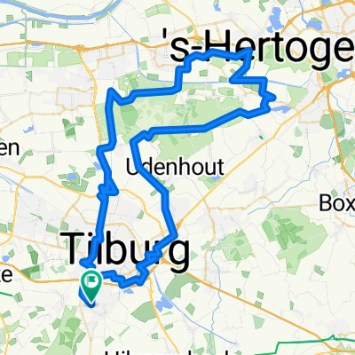
Mooi Brabant WTC De Hellen
A cycling route starting in Goirle, North Brabant, Netherlands.
Overview
About this route
Route over een autoluwe wegen. Erg de moeite waard.
- -:--
- Duration
- 98.2 km
- Distance
- 68 m
- Ascent
- 72 m
- Descent
- ---
- Avg. speed
- 26 m
- Avg. speed

Route quality
Waytypes & surfaces along the route
Waytypes
Quiet road
40.6 km
(41 %)
Cycleway
37.5 km
(38 %)
Surfaces
Paved
51 km
(52 %)
Unpaved
2 km
(2 %)
Asphalt
37.3 km
(38 %)
Paving stones
9.6 km
(10 %)
Continue with Bikemap
Use, edit, or download this cycling route
You would like to ride Mooi Brabant WTC De Hellen or customize it for your own trip? Here is what you can do with this Bikemap route:
Free features
- Save this route as favorite or in collections
- Copy & plan your own version of this route
- Sync your route with Garmin or Wahoo
Premium features
Free trial for 3 days, or one-time payment. More about Bikemap Premium.
- Navigate this route on iOS & Android
- Export a GPX / KML file of this route
- Create your custom printout (try it for free)
- Download this route for offline navigation
Discover more Premium features.
Get Bikemap PremiumFrom our community
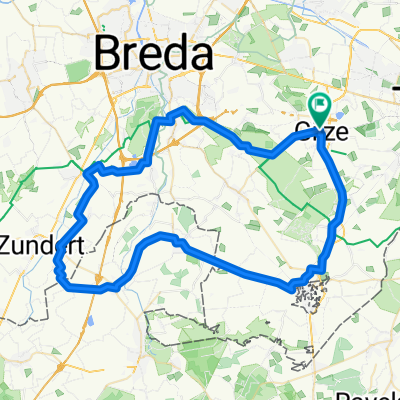
Other popular routes starting in Goirle
 NO 85 - Goirle - Snelfietsroute Tilburg Waalwijk - Nieuwkuik > Cromvoirt > Drunense Duinen - Berkel-Enschot - Goirle
- Distance
- 86.3 km
- Ascent
- 125 m
- Descent
- 126 m
- Location
- Goirle, North Brabant, Netherlands
 MTB Toertocht Goirle 2010
- Distance
- 55.2 km
- Ascent
- 70 m
- Descent
- 70 m
- Location
- Goirle, North Brabant, Netherlands
 ZW 110 - Goirle - Hilvarenbeek - Diessen - Baarschot - Vessem - Duizel - kanaal bij Arendonk - Turnhout - Merksplas - Zondereigen - Baarle Nassau - Bels Lijntje
- Distance
- 110 km
- Ascent
- 76 m
- Descent
- 78 m
- Location
- Goirle, North Brabant, Netherlands
 Pondjes route
- Distance
- 64.5 km
- Ascent
- 53 m
- Descent
- 56 m
- Location
- Goirle, North Brabant, Netherlands
 NO 65 - Goirle - Tilburg - snelfietsroute Loon op Zand - Drunense Duinen - Haaren - Oisterwijk - Goirle
- Distance
- 67.1 km
- Ascent
- 89 m
- Descent
- 90 m
- Location
- Goirle, North Brabant, Netherlands
 Rondje Moerenburg LaTrappe
- Distance
- 31.5 km
- Ascent
- 28 m
- Descent
- 30 m
- Location
- Goirle, North Brabant, Netherlands
 Route A
- Distance
- 65.4 km
- Ascent
- 62 m
- Descent
- 60 m
- Location
- Goirle, North Brabant, Netherlands
 Tlb,Glz,Alph,B-N,Pppl,Sbk,Hbk,Grl.
- Distance
- 55.4 km
- Ascent
- 70 m
- Descent
- 69 m
- Location
- Goirle, North Brabant, Netherlands