

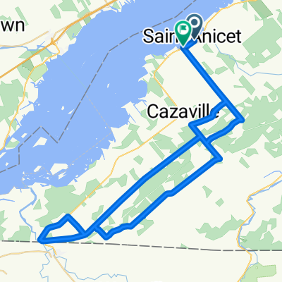
Grand circuit du Haut-Saint-Laurent
A cycling route starting in Huntingdon, Quebec, Canada.
Overview
About this route
Ce parcours de plus de 150 KM vous fera découvrir les plus beaux coins cachés de la région du Haut-Saint-Laurent, au sud-ouest du Québec. Vous tomberez assurément sous le charme.
- -:--
- Duration
- 154.4 km
- Distance
- 196 m
- Ascent
- 196 m
- Descent
- ---
- Avg. speed
- ---
- Avg. speed

Route quality
Waytypes & surfaces along the route
Waytypes
Road
86.2 km
(56 %)
Busy road
42.7 km
(28 %)
Surfaces
Paved
53.3 km
(35 %)
Unpaved
3.5 km
(2 %)
Asphalt
32.1 km
(21 %)
Paved (undefined)
21.2 km
(14 %)
Route highlights
Points of interest along the route
Point of interest after 52.1 km
Pont couvert Percy Covered Bridge
Drinking water after 66.9 km
-Halte vélo Cidrerie Frier- Accueil des cyclistes de mai à novembre. Toilettes et aire de repos. Ravitaillement en eau et breuvages sportifs. - Bike stop Frier Orchard - Welcome cyclists from May to November. Restrooms and rest area. Water and sports drinks refill.
Bike service after 66.9 km
Verger Frier - Cidrerie Rockburn
Point of interest after 66.9 km
-Le pub Rockburn- Ouvert depuis 1985, le Pub Rockburn est réputé pour ses caractéristiques irlandaises. -Rockburn Pub- Opened in 1985, The Rockburn Pub is known for its British style in a country setting.
Point of interest after 112.5 km
Lieu historique National de la Bataille-de-la-Châteauguay Battle of the Châteauguay National Historic Site

Point of interest after 119 km
Restaurant Taverne de la Ferme. Pub convivial et festif axé sur les produits locaux. Taverne de la Ferme Restaurant Welcoming and lively pub with a social atmosphere and an emphasis on local products.

Point of interest after 119.3 km
Relais d'information touristique Tourist information relay

Point of interest after 137.1 km
Kiosque d'information touristique. Ouvert de la fin juin à la fin août. Tourist information kiosk. Open from end June to end August.
Continue with Bikemap
Use, edit, or download this cycling route
You would like to ride Grand circuit du Haut-Saint-Laurent or customize it for your own trip? Here is what you can do with this Bikemap route:
Free features
- Save this route as favorite or in collections
- Copy & plan your own version of this route
- Sync your route with Garmin or Wahoo
Premium features
Free trial for 3 days, or one-time payment. More about Bikemap Premium.
- Navigate this route on iOS & Android
- Export a GPX / KML file of this route
- Create your custom printout (try it for free)
- Download this route for offline navigation
Discover more Premium features.
Get Bikemap PremiumFrom our community
Other popular routes starting in Huntingdon
 22 avril
- Distance
- 30.2 km
- Ascent
- 56 m
- Descent
- 55 m
- Location
- Huntingdon, Quebec, Canada
 Lake placid via saranac lake
- Distance
- 114 km
- Ascent
- 866 m
- Descent
- 324 m
- Location
- Huntingdon, Quebec, Canada
 St-Anicet; clockwise 63 kms
- Distance
- 57.8 km
- Ascent
- 70 m
- Descent
- 73 m
- Location
- Huntingdon, Quebec, Canada
 Little ride to Dewittville.
- Distance
- 15.4 km
- Ascent
- 29 m
- Descent
- 26 m
- Location
- Huntingdon, Quebec, Canada
 Adirondack nord-est
- Distance
- 101.6 km
- Ascent
- 628 m
- Descent
- 628 m
- Location
- Huntingdon, Quebec, Canada
 Saint -Anicet corrigé
- Distance
- 55.9 km
- Ascent
- 101 m
- Descent
- 100 m
- Location
- Huntingdon, Quebec, Canada
 Circuit des frontières
- Distance
- 146.1 km
- Ascent
- 152 m
- Descent
- 154 m
- Location
- Huntingdon, Quebec, Canada
 18-mai-2012
- Distance
- 59.6 km
- Ascent
- 143 m
- Descent
- 138 m
- Location
- Huntingdon, Quebec, Canada
Open it in the app