

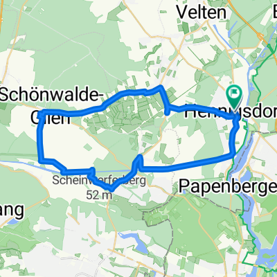
15_Hennigsdorf – Spandau – Potsdam
A cycling route starting in Hennigsdorf, Brandenburg, Germany.
Overview
About this route
Auf grünen Wegen durch die Hauptstadt Charakter: Die Tour führt zum großen Teil durch Berlin sowie die angrenzenden Orte. Durch die langen Passagen am Wasser sieht man erstaunlich viel Grün. Der Havel- Radweg ist zwar gut ausgeschildert, trotzdem erfordert die Orientierung Zeit und Konzentration. Verkehr: Überwiegend Uferwege und Sträßchen durch Einfamilienhaus-Gebiete. An verkehrs- reichen Straßen gibt es fast immer Radwege. KOMPASS 6015 Havel-Radweg, Christian Nowak, ISBN 978-3-85026-933-9
- -:--
- Duration
- 45.1 km
- Distance
- 119 m
- Ascent
- 118 m
- Descent
- ---
- Avg. speed
- ---
- Avg. speed
Continue with Bikemap
Use, edit, or download this cycling route
You would like to ride 15_Hennigsdorf – Spandau – Potsdam or customize it for your own trip? Here is what you can do with this Bikemap route:
Free features
- Save this route as favorite or in collections
- Copy & plan your own version of this route
- Sync your route with Garmin or Wahoo
Premium features
Free trial for 3 days, or one-time payment. More about Bikemap Premium.
- Navigate this route on iOS & Android
- Export a GPX / KML file of this route
- Create your custom printout (try it for free)
- Download this route for offline navigation
Discover more Premium features.
Get Bikemap PremiumFrom our community
Other popular routes starting in Hennigsdorf
 Geile Route übern Mauerweg, ehem. FlughafenTempelhof
- Distance
- 41.6 km
- Ascent
- 68 m
- Descent
- 60 m
- Location
- Hennigsdorf, Brandenburg, Germany
 Henningsdorf-Potsdam
- Distance
- 60.7 km
- Ascent
- 139 m
- Descent
- 139 m
- Location
- Hennigsdorf, Brandenburg, Germany
 15_Hennigsdorf – Spandau – Potsdam
- Distance
- 45.1 km
- Ascent
- 119 m
- Descent
- 118 m
- Location
- Hennigsdorf, Brandenburg, Germany
 X-Berlin - 4X Wyndham Garden - Ibis Budget
- Distance
- 45.8 km
- Ascent
- 224 m
- Descent
- 220 m
- Location
- Hennigsdorf, Brandenburg, Germany
 Moderate route in Hennigsdorf
- Distance
- 19.3 km
- Ascent
- 0 m
- Descent
- 27 m
- Location
- Hennigsdorf, Brandenburg, Germany
 Marwitzer Straße, Hennigsdorf nach Bötzow, Oberkrämer
- Distance
- 5.4 km
- Ascent
- 24 m
- Descent
- 30 m
- Location
- Hennigsdorf, Brandenburg, Germany
 Hennigsdorf (kurz)
- Distance
- 35 km
- Ascent
- 32 m
- Descent
- 31 m
- Location
- Hennigsdorf, Brandenburg, Germany
 Loopsie loop from Henni
- Distance
- 33.3 km
- Ascent
- 50 m
- Descent
- 50 m
- Location
- Hennigsdorf, Brandenburg, Germany
Open it in the app