

Hohenloher Ride
A cycling route starting in Rot am See, Baden-Württemberg, Germany.
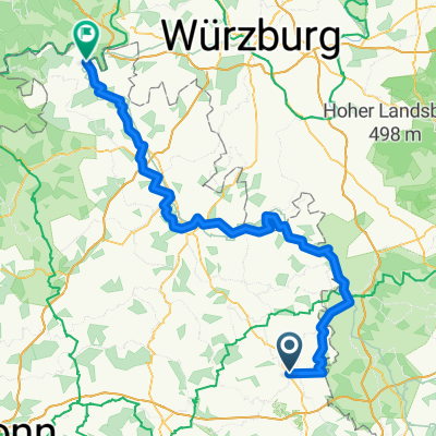
Overview
About this route
Blaufelden, Rot am See, Schrozberg, Ilshofen
- -:--
- Duration
- 12.5 km
- Distance
- 118 m
- Ascent
- 114 m
- Descent
- ---
- Avg. speed
- ---
- Avg. speed

Route quality
Waytypes & surfaces along the route
Waytypes
Quiet road
9.2 km
(74 %)
Road
1.6 km
(13 %)
Surfaces
Paved
1.2 km
(9 %)
Unpaved
0.9 km
(7 %)
Asphalt
0.9 km
(7 %)
Unpaved (undefined)
0.5 km
(4 %)
Continue with Bikemap
Use, edit, or download this cycling route
You would like to ride Hohenloher Ride or customize it for your own trip? Here is what you can do with this Bikemap route:
Free features
- Save this route as favorite or in collections
- Copy & plan your own version of this route
- Sync your route with Garmin or Wahoo
Premium features
Free trial for 3 days, or one-time payment. More about Bikemap Premium.
- Navigate this route on iOS & Android
- Export a GPX / KML file of this route
- Create your custom printout (try it for free)
- Download this route for offline navigation
Discover more Premium features.
Get Bikemap PremiumFrom our community
Other popular routes starting in Rot am See
 Tauber- Radweg Quelle Mündung
- Distance
- 125 km
- Ascent
- 989 m
- Descent
- 1,269 m
- Location
- Rot am See, Baden-Württemberg, Germany
 Crailsheimer Straße 13, Rot am See nach Crailsheimer Straße 13, Rot am See
- Distance
- 70 km
- Ascent
- 641 m
- Descent
- 641 m
- Location
- Rot am See, Baden-Württemberg, Germany
 TransTaubertal via Panoramaweg
- Distance
- 136.6 km
- Ascent
- 1,241 m
- Descent
- 1,497 m
- Location
- Rot am See, Baden-Württemberg, Germany
 Tour Reichertswisen
- Distance
- 71 km
- Ascent
- 534 m
- Descent
- 540 m
- Location
- Rot am See, Baden-Württemberg, Germany
 Reichertswiesen
- Distance
- 76.9 km
- Ascent
- 792 m
- Descent
- 786 m
- Location
- Rot am See, Baden-Württemberg, Germany
 Frankenweg 11, Rot am See nach Gerabronner Straße 5, Rot am See
- Distance
- 14.9 km
- Ascent
- 940 m
- Descent
- 946 m
- Location
- Rot am See, Baden-Württemberg, Germany
 random runde
- Distance
- 29.3 km
- Ascent
- 729 m
- Descent
- 688 m
- Location
- Rot am See, Baden-Württemberg, Germany
 6. Tag
- Distance
- 99.2 km
- Ascent
- 305 m
- Descent
- 546 m
- Location
- Rot am See, Baden-Württemberg, Germany
Open it in the app