

Matajur Hike
A cycling route starting in Kobarid, Občina Kobarid, Slovenia.
Overview
About this route
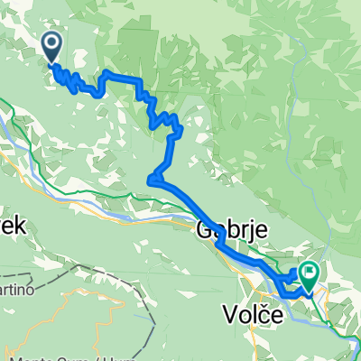
Raggiunto il rifugio Pelizzo dalla comoda strada che parte da Savogna, si segue il sentiero che in salita punta verso la Chiesetta del Redentore posta sulla cima del monte a 1641mt di dislivello. Raggiunta la vetta si scende verso ovest in direzione del Rifugio Dom. Da qua si scende a nord verso le malghe. Giunti al laghetto si prosegue per la traccia principale per riprendere il sentiero a sinistra che ci ricondurrà al Rifugio Pelizzo.
From Rifugio Pelizzo, a guest-house easy to reach following the main route from the village of Savogna, take the path that goes uphill in the direction of the chapel Chiesetta del Redentore situated on the top of the mount Matajur at about 1641 mt. When on top, to descent, take the West in the direction of Rifugio Dom. From this point go north and reach a little lake. Continue on the main path to connect with the road that leads back to Rifugio Pelizzo.
- -:--
- Duration
- 4.2 km
- Distance
- 317 m
- Ascent
- 316 m
- Descent
- ---
- Avg. speed
- ---
- Avg. speed

Continue with Bikemap
Use, edit, or download this cycling route
You would like to ride Matajur Hike or customize it for your own trip? Here is what you can do with this Bikemap route:
Free features
- Save this route as favorite or in collections
- Copy & plan your own version of this route
- Sync your route with Garmin or Wahoo
Premium features
Free trial for 3 days, or one-time payment. More about Bikemap Premium.
- Navigate this route on iOS & Android
- Export a GPX / KML file of this route
- Create your custom printout (try it for free)
- Download this route for offline navigation
Discover more Premium features.
Get Bikemap PremiumFrom our community
Other popular routes starting in Kobarid
 MTB Slowenien Soca Tour 18
- Distance
- 41.7 km
- Ascent
- 1,237 m
- Descent
- 1,239 m
- Location
- Kobarid, Občina Kobarid, Slovenia
 Untitled route
- Distance
- 48.6 km
- Ascent
- 859 m
- Descent
- 1,996 m
- Location
- Kobarid, Občina Kobarid, Slovenia
 Alpe-Adria Trail 4-5
- Distance
- 24 km
- Ascent
- 901 m
- Descent
- 1,302 m
- Location
- Kobarid, Občina Kobarid, Slovenia
 MTB Slowenien Soca - Tour 12
- Distance
- 15.4 km
- Ascent
- 704 m
- Descent
- 704 m
- Location
- Kobarid, Občina Kobarid, Slovenia
 Kobarid -> Bovec
- Distance
- 23.1 km
- Ascent
- 776 m
- Descent
- 568 m
- Location
- Kobarid, Občina Kobarid, Slovenia
 MTB Slowenien Soca Tour 13
- Distance
- 40.7 km
- Ascent
- 1,795 m
- Descent
- 1,795 m
- Location
- Kobarid, Občina Kobarid, Slovenia
 Ob Nadiži
- Distance
- 43.8 km
- Ascent
- 719 m
- Descent
- 719 m
- Location
- Kobarid, Občina Kobarid, Slovenia
 Breginjski krog (ob Nadiži)
- Distance
- 26.9 km
- Ascent
- 554 m
- Descent
- 563 m
- Location
- Kobarid, Občina Kobarid, Slovenia
Open it in the app