

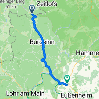
Sinntal: von Jossa bis Gemünden am Main
A cycling route starting in Obersinn, Bavaria, Germany.
Overview
About this route
entlang der Sinngrund
- -:--
- Duration
- 31.4 km
- Distance
- 170 m
- Ascent
- 259 m
- Descent
- ---
- Avg. speed
- ---
- Avg. speed
Route quality
Waytypes & surfaces along the route
Waytypes
Track
12.9 km
(41 %)
Quiet road
12.3 km
(39 %)
Surfaces
Paved
26.4 km
(84 %)
Unpaved
2.6 km
(8 %)
Asphalt
25.6 km
(81 %)
Gravel
2 km
(6 %)
Continue with Bikemap
Use, edit, or download this cycling route
You would like to ride Sinntal: von Jossa bis Gemünden am Main or customize it for your own trip? Here is what you can do with this Bikemap route:
Free features
- Save this route as favorite or in collections
- Copy & plan your own version of this route
- Sync your route with Garmin or Wahoo
Premium features
Free trial for 3 days, or one-time payment. More about Bikemap Premium.
- Navigate this route on iOS & Android
- Export a GPX / KML file of this route
- Create your custom printout (try it for free)
- Download this route for offline navigation
Discover more Premium features.
Get Bikemap PremiumFrom our community
Other popular routes starting in Obersinn
 Tour de Bayerisch Schanz
- Distance
- 73.2 km
- Ascent
- 1,275 m
- Descent
- 1,230 m
- Location
- Obersinn, Bavaria, Germany
 Route from Honigrückweg 2, Sinntal
- Distance
- 29.1 km
- Ascent
- 407 m
- Descent
- 472 m
- Location
- Obersinn, Bavaria, Germany
 Jossa - Bad Brückenau - Bischofsheim
- Distance
- 44.3 km
- Ascent
- 564 m
- Descent
- 344 m
- Location
- Obersinn, Bavaria, Germany
 Besuch an der Buhne
- Distance
- 72.7 km
- Ascent
- 511 m
- Descent
- 511 m
- Location
- Obersinn, Bavaria, Germany
 Schondratal
- Distance
- 52.9 km
- Ascent
- 657 m
- Descent
- 657 m
- Location
- Obersinn, Bavaria, Germany
 Jossa-Gemünde-Jossa (Sinntal)
- Distance
- 87.2 km
- Ascent
- 552 m
- Descent
- 552 m
- Location
- Obersinn, Bavaria, Germany
 2013 Jossa-Morlesau (Sinntal-Fränkische Saale)
- Distance
- 55.4 km
- Ascent
- 201 m
- Descent
- 239 m
- Location
- Obersinn, Bavaria, Germany
 2009 Jossa-Werntal
- Distance
- 35 km
- Ascent
- 155 m
- Descent
- 245 m
- Location
- Obersinn, Bavaria, Germany
Open it in the app