

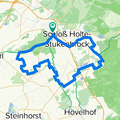
SHS 1 Schloss Holte
A cycling route starting in Oerlinghausen, North Rhine-Westphalia, Germany.
Overview
About this route
- -:--
- Duration
- 27.1 km
- Distance
- 110 m
- Ascent
- 113 m
- Descent
- ---
- Avg. speed
- ---
- Avg. speed
Route quality
Waytypes & surfaces along the route
Waytypes
Quiet road
12.6 km
(47 %)
Access road
3.6 km
(13 %)
Surfaces
Paved
13.7 km
(51 %)
Unpaved
3.4 km
(12 %)
Asphalt
13.5 km
(50 %)
Gravel
1.8 km
(7 %)
Continue with Bikemap
Use, edit, or download this cycling route
You would like to ride SHS 1 Schloss Holte or customize it for your own trip? Here is what you can do with this Bikemap route:
Free features
- Save this route as favorite or in collections
- Copy & plan your own version of this route
- Sync your route with Garmin or Wahoo
Premium features
Free trial for 3 days, or one-time payment. More about Bikemap Premium.
- Navigate this route on iOS & Android
- Export a GPX / KML file of this route
- Create your custom printout (try it for free)
- Download this route for offline navigation
Discover more Premium features.
Get Bikemap PremiumFrom our community
Other popular routes starting in Oerlinghausen
 Leopoldshöhe>Steinhorster Becken
- Distance
- 72.6 km
- Ascent
- 275 m
- Descent
- 254 m
- Location
- Oerlinghausen, North Rhine-Westphalia, Germany
 85 Vlotho-A2-B.Oe.-Löhne-HF
- Distance
- 85 km
- Ascent
- 281 m
- Descent
- 283 m
- Location
- Oerlinghausen, North Rhine-Westphalia, Germany
 Rund um Leopoldshöhe von HaPe
- Distance
- 24.7 km
- Ascent
- 133 m
- Descent
- 139 m
- Location
- Oerlinghausen, North Rhine-Westphalia, Germany
 Schloß Holte - Herrmansdenkmal
- Distance
- 44.2 km
- Ascent
- 562 m
- Descent
- 520 m
- Location
- Oerlinghausen, North Rhine-Westphalia, Germany
 Schl. Holte Sennebäche
- Distance
- 36.3 km
- Ascent
- 90 m
- Descent
- 92 m
- Location
- Oerlinghausen, North Rhine-Westphalia, Germany
 Tönsberg bis Teiche
- Distance
- 25.5 km
- Ascent
- 508 m
- Descent
- 515 m
- Location
- Oerlinghausen, North Rhine-Westphalia, Germany
 Oerlinghausen-Hermannsdenkmal
- Distance
- 34.5 km
- Ascent
- 674 m
- Descent
- 674 m
- Location
- Oerlinghausen, North Rhine-Westphalia, Germany
 Fahrt durchs Ochsengehege
- Distance
- 16.5 km
- Ascent
- 403 m
- Descent
- 403 m
- Location
- Oerlinghausen, North Rhine-Westphalia, Germany
Open it in the app