
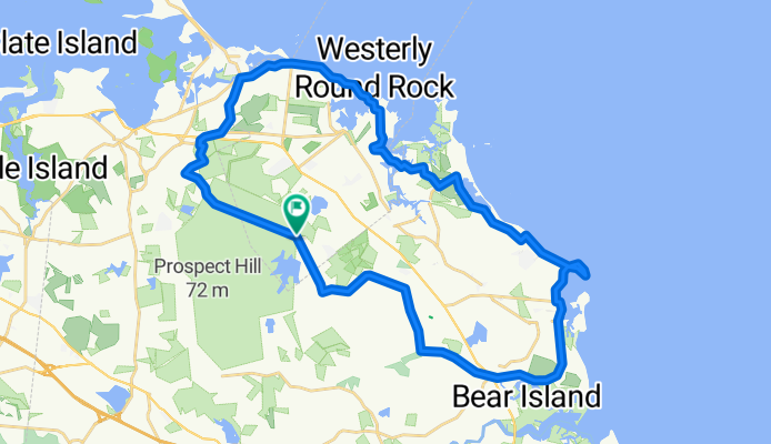
24-mile Wompatuck/Scituate Loop
A cycling route starting in North Scituate, Massachusetts, United States of America.
Overview
About this route
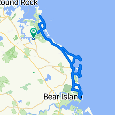
Park and Start at Wompatuck State Park, ride up to Hull's border and down the coast to Scituate light house then close the loop back to Wompi.
- -:--
- Duration
- 39.4 km
- Distance
- 187 m
- Ascent
- 185 m
- Descent
- ---
- Avg. speed
- ---
- Avg. speed
Route quality
Waytypes & surfaces along the route
Waytypes
Road
14.8 km
(38 %)
Busy road
10 km
(25 %)
Surfaces
Paved
16.7 km
(42 %)
Unpaved
0.5 km
(1 %)
Asphalt
16.7 km
(42 %)
Unpaved (undefined)
0.5 km
(1 %)
Undefined
22.2 km
(56 %)
Continue with Bikemap
Use, edit, or download this cycling route
You would like to ride 24-mile Wompatuck/Scituate Loop or customize it for your own trip? Here is what you can do with this Bikemap route:
Free features
- Save this route as favorite or in collections
- Copy & plan your own version of this route
- Sync your route with Garmin or Wahoo
Premium features
Free trial for 3 days, or one-time payment. More about Bikemap Premium.
- Navigate this route on iOS & Android
- Export a GPX / KML file of this route
- Create your custom printout (try it for free)
- Download this route for offline navigation
Discover more Premium features.
Get Bikemap PremiumFrom our community
Other popular routes starting in North Scituate
 Moderate route in Scituate
- Distance
- 5 km
- Ascent
- 69 m
- Descent
- 71 m
- Location
- North Scituate, Massachusetts, United States of America
 wompatuck to home
- Distance
- 32.9 km
- Ascent
- 278 m
- Descent
- 305 m
- Location
- North Scituate, Massachusetts, United States of America
 Gannett Road 221, Scituate to Gannett Road 221, Scituate
- Distance
- 32.4 km
- Ascent
- 3 m
- Descent
- 26 m
- Location
- North Scituate, Massachusetts, United States of America
 150 Border St, Scituate to 150 Border St, Scituate
- Distance
- 19.6 km
- Ascent
- 159 m
- Descent
- 161 m
- Location
- North Scituate, Massachusetts, United States of America
 Route to Beechwood St, Norwell
- Distance
- 8.3 km
- Ascent
- 43 m
- Descent
- 40 m
- Location
- North Scituate, Massachusetts, United States of America
 10 Mile Route
- Distance
- 14.5 km
- Ascent
- 79 m
- Descent
- 69 m
- Location
- North Scituate, Massachusetts, United States of America
 Bittersweet Ln, Scituate to Seagate Cir, Scituate
- Distance
- 4.9 km
- Ascent
- 26 m
- Descent
- 38 m
- Location
- North Scituate, Massachusetts, United States of America
 regular beach no bridge
- Distance
- 16.4 km
- Ascent
- 68 m
- Descent
- 65 m
- Location
- North Scituate, Massachusetts, United States of America
Open it in the app