

Skyrace Alta Valtellina
A cycling route starting in Isolaccia, Lombardy, Italy.
Overview
About this route
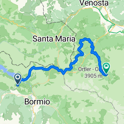
6^ Edizione della Gara di Corsa in Montagna in Val Viola. Percorso mozzafiato su sentieri e single tracks.
6th Edition of the Mountain Running Race in Val Viola. Amazing track along trails and single tracks.
- -:--
- Duration
- 20.5 km
- Distance
- 756 m
- Ascent
- 749 m
- Descent
- ---
- Avg. speed
- ---
- Avg. speed

Continue with Bikemap
Use, edit, or download this cycling route
You would like to ride Skyrace Alta Valtellina or customize it for your own trip? Here is what you can do with this Bikemap route:
Free features
- Save this route as favorite or in collections
- Copy & plan your own version of this route
- Sync your route with Garmin or Wahoo
Premium features
Free trial for 3 days, or one-time payment. More about Bikemap Premium.
- Navigate this route on iOS & Android
- Export a GPX / KML file of this route
- Create your custom printout (try it for free)
- Download this route for offline navigation
Discover more Premium features.
Get Bikemap PremiumFrom our community
Other popular routes starting in Isolaccia
 Bike-Tour 2025 Etappe3
- Distance
- 53.7 km
- Ascent
- 1,655 m
- Descent
- 2,662 m
- Location
- Isolaccia, Lombardy, Italy
 Alta Valtellina Bike 2016 - Classic
- Distance
- 64.9 km
- Ascent
- 1,654 m
- Descent
- 1,656 m
- Location
- Isolaccia, Lombardy, Italy
 Skyrace Alta Valtellina
- Distance
- 20.6 km
- Ascent
- 822 m
- Descent
- 829 m
- Location
- Isolaccia, Lombardy, Italy
 Alpencross 2010 | Etappe 4
- Distance
- 46.9 km
- Ascent
- 2,021 m
- Descent
- 2,121 m
- Location
- Isolaccia, Lombardy, Italy
 Isolaccia - Stelvio - Isolaccia
- Distance
- 56 km
- Ascent
- 1,979 m
- Descent
- 1,666 m
- Location
- Isolaccia, Lombardy, Italy
 _ITA _ Raetian Alps - Isolaccia - Torri di Fraele - Bormio - Isolaccia
- Distance
- 45.9 km
- Ascent
- 1,000 m
- Descent
- 1,000 m
- Location
- Isolaccia, Lombardy, Italy
 Bike-Tour 2025 Etappe3
- Distance
- 54.6 km
- Ascent
- 1,786 m
- Descent
- 2,794 m
- Location
- Isolaccia, Lombardy, Italy
 Giro d`Italia 2008 - stage 6
- Distance
- 95.7 km
- Ascent
- 3,131 m
- Descent
- 3,128 m
- Location
- Isolaccia, Lombardy, Italy
Open it in the app