

Saintois Sud
A cycling route starting in Villers-lès-Nancy, Alsace-Champagne-Ardenne-Lorraine, France.
Overview
About this route
Boucle par la partie sud du Saintois, avec une petite incursion dans le département des Vosges. Une belle alternative à la boucle de Sion – surtout au printemps quand les arbres fruitiers sont en fleurs. En fait, le dénivelé est de 1200 m (perte d'information lors du transfert du fichier GPX).
- -:--
- Duration
- 106.4 km
- Distance
- 741 m
- Ascent
- 742 m
- Descent
- ---
- Avg. speed
- ---
- Avg. speed
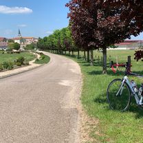
Route photos

Route quality
Waytypes & surfaces along the route
Waytypes
Road
57.1 km
(54 %)
Busy road
22.3 km
(21 %)
Surfaces
Paved
33.9 km
(32 %)
Unpaved
0.3 km
(<1 %)
Asphalt
33.4 km
(31 %)
Paved (undefined)
0.4 km
(<1 %)
Continue with Bikemap
Use, edit, or download this cycling route
You would like to ride Saintois Sud or customize it for your own trip? Here is what you can do with this Bikemap route:
Free features
- Save this route as favorite or in collections
- Copy & plan your own version of this route
- Sync your route with Garmin or Wahoo
Premium features
Free trial for 3 days, or one-time payment. More about Bikemap Premium.
- Navigate this route on iOS & Android
- Export a GPX / KML file of this route
- Create your custom printout (try it for free)
- Download this route for offline navigation
Discover more Premium features.
Get Bikemap PremiumFrom our community
Other popular routes starting in Villers-lès-Nancy
 Nancy - Vittel
- Distance
- 85.6 km
- Ascent
- 668 m
- Descent
- 566 m
- Location
- Villers-lès-Nancy, Alsace-Champagne-Ardenne-Lorraine, France
 Thélod
- Distance
- 80 km
- Ascent
- 937 m
- Descent
- 937 m
- Location
- Villers-lès-Nancy, Alsace-Champagne-Ardenne-Lorraine, France
 Côte de Toul - Gélaucourt
- Distance
- 101.9 km
- Ascent
- 1,050 m
- Descent
- 1,051 m
- Location
- Villers-lès-Nancy, Alsace-Champagne-Ardenne-Lorraine, France
 Nancy - Bèze (Côte d’Or)
- Distance
- 243.1 km
- Ascent
- 1,631 m
- Descent
- 1,648 m
- Location
- Villers-lès-Nancy, Alsace-Champagne-Ardenne-Lorraine, France
 Bitche
- Distance
- 132.4 km
- Ascent
- 632 m
- Descent
- 545 m
- Location
- Villers-lès-Nancy, Alsace-Champagne-Ardenne-Lorraine, France
 Hattonchâtel
- Distance
- 79 km
- Ascent
- 456 m
- Descent
- 342 m
- Location
- Villers-lès-Nancy, Alsace-Champagne-Ardenne-Lorraine, France
 Donon – Rabodeau
- Distance
- 127.9 km
- Ascent
- 992 m
- Descent
- 928 m
- Location
- Villers-lès-Nancy, Alsace-Champagne-Ardenne-Lorraine, France
 nancy - maron - liverdun
- Distance
- 56.9 km
- Ascent
- 482 m
- Descent
- 485 m
- Location
- Villers-lès-Nancy, Alsace-Champagne-Ardenne-Lorraine, France
Open it in the app