

2018 Mont Ste-Odile round trip
A cycling route starting in Sainte-Croix-aux-Mines, Grand Est, France.
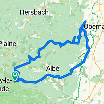
Overview
About this route
Variant on ride to Mont Ste-Odile from 2017, but including visit to Boersch, picturesque walled village with fine medieval fortifications and Renaissance arhitecture; long climb to Mont Ste-Odile afterwards, but then long descent enjoyed in 2017, final col to finish; moderate. Car transfer to start, 56 kms, 1 Hour 10 mins
- -:--
- Duration
- 86.7 km
- Distance
- 1,293 m
- Ascent
- 1,296 m
- Descent
- ---
- Avg. speed
- ---
- Max. altitude
Route quality
Waytypes & surfaces along the route
Waytypes
Busy road
65.4 km
(75 %)
Road
11 km
(13 %)
Surfaces
Paved
31.9 km
(37 %)
Unpaved
2.7 km
(3 %)
Asphalt
31.8 km
(37 %)
Ground
1.7 km
(2 %)
Continue with Bikemap
Use, edit, or download this cycling route
You would like to ride 2018 Mont Ste-Odile round trip or customize it for your own trip? Here is what you can do with this Bikemap route:
Free features
- Save this route as favorite or in collections
- Copy & plan your own version of this route
- Split it into stages to create a multi-day tour
- Sync your route with Garmin or Wahoo
Premium features
Free trial for 3 days, or one-time payment. More about Bikemap Premium.
- Navigate this route on iOS & Android
- Export a GPX / KML file of this route
- Create your custom printout (try it for free)
- Download this route for offline navigation
Discover more Premium features.
Get Bikemap PremiumFrom our community
Other popular routes starting in Sainte-Croix-aux-Mines
 rombach-le-F 2190hm 121km
- Distance
- 121.4 km
- Ascent
- 1,874 m
- Descent
- 1,880 m
- Location
- Sainte-Croix-aux-Mines, Grand Est, France
 TP 20160912 VAR2 VILLE Erweiterung
- Distance
- 11.8 km
- Ascent
- 419 m
- Descent
- 502 m
- Location
- Sainte-Croix-aux-Mines, Grand Est, France
 Rombach le Franc 1.2
- Distance
- 59.9 km
- Ascent
- 1,083 m
- Descent
- 1,076 m
- Location
- Sainte-Croix-aux-Mines, Grand Est, France
 Day 5 Cedar
- Distance
- 64.8 km
- Ascent
- 497 m
- Descent
- 695 m
- Location
- Sainte-Croix-aux-Mines, Grand Est, France
 TE_2017_Etappe4
- Distance
- 127.4 km
- Ascent
- 1,754 m
- Descent
- 2,108 m
- Location
- Sainte-Croix-aux-Mines, Grand Est, France
 2018 Mont Ste-Odile round trip
- Distance
- 86.7 km
- Ascent
- 1,293 m
- Descent
- 1,296 m
- Location
- Sainte-Croix-aux-Mines, Grand Est, France
 Rombach Straßbourg
- Distance
- 87.4 km
- Ascent
- 371 m
- Descent
- 633 m
- Location
- Sainte-Croix-aux-Mines, Grand Est, France
 Rombach-l-Franc 920HM-108km
- Distance
- 107.8 km
- Ascent
- 736 m
- Descent
- 737 m
- Location
- Sainte-Croix-aux-Mines, Grand Est, France
Open it in the app