

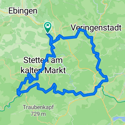
Straßberg - Laucherttal - Burladingen - Gomaringen
A cycling route starting in Straßberg, Baden-Württemberg, Germany.
Overview
About this route
Streckenteile des
-
Bike-X-ing Schwäbische Alb
-
Laucherttal-Radweg
- -:--
- Duration
- 90.2 km
- Distance
- 1,429 m
- Ascent
- 1,356 m
- Descent
- ---
- Avg. speed
- 866 m
- Avg. speed
Route quality
Waytypes & surfaces along the route
Waytypes
Track
56.9 km
(63 %)
Quiet road
19.7 km
(22 %)
Surfaces
Paved
47 km
(52 %)
Unpaved
34 km
(38 %)
Asphalt
32.3 km
(36 %)
Gravel
28.2 km
(31 %)
Continue with Bikemap
Use, edit, or download this cycling route
You would like to ride Straßberg - Laucherttal - Burladingen - Gomaringen or customize it for your own trip? Here is what you can do with this Bikemap route:
Free features
- Save this route as favorite or in collections
- Copy & plan your own version of this route
- Sync your route with Garmin or Wahoo
Premium features
Free trial for 3 days, or one-time payment. More about Bikemap Premium.
- Navigate this route on iOS & Android
- Export a GPX / KML file of this route
- Create your custom printout (try it for free)
- Download this route for offline navigation
Discover more Premium features.
Get Bikemap PremiumFrom our community
Other popular routes starting in Straßberg
 Rundtour Straßberg-Fehlatahl-Bütnautal-Straßberg
- Distance
- 60.1 km
- Ascent
- 639 m
- Descent
- 639 m
- Location
- Straßberg, Baden-Württemberg, Germany
 Straßberg - Laucherttal - Donautal - Werenwag - Stetten a.k.M.
- Distance
- 76 km
- Ascent
- 1,365 m
- Descent
- 1,286 m
- Location
- Straßberg, Baden-Württemberg, Germany
 Straßberg - Burladingen - Onstmettingen
- Distance
- 68.9 km
- Ascent
- 1,272 m
- Descent
- 1,145 m
- Location
- Straßberg, Baden-Württemberg, Germany
 Samstagnachmittag -Tour
- Distance
- 33.5 km
- Ascent
- 462 m
- Descent
- 462 m
- Location
- Straßberg, Baden-Württemberg, Germany
 Auf und ab rund um Straßberg
- Distance
- 38.2 km
- Ascent
- 936 m
- Descent
- 936 m
- Location
- Straßberg, Baden-Württemberg, Germany
 Sontagstour Straßberg-Kaiseringen-Benzingen-Lauchettal-Hermantingen-Fehlatal-Bitz-Winterlingen-Straßberg
- Distance
- 50.1 km
- Ascent
- 534 m
- Descent
- 531 m
- Location
- Straßberg, Baden-Württemberg, Germany
 Herbstausfahrt über die Fürstenhöhe ins Donautal
- Distance
- 68.7 km
- Ascent
- 634 m
- Descent
- 621 m
- Location
- Straßberg, Baden-Württemberg, Germany
 Straßberg - Laucherttal - Burladingen - Gomaringen
- Distance
- 90.2 km
- Ascent
- 1,429 m
- Descent
- 1,356 m
- Location
- Straßberg, Baden-Württemberg, Germany
Open it in the app