

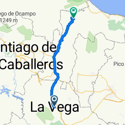
Moderate Afternoon Ride In La Vega
A cycling route starting in Concepción de la Vega, Provincia de La Vega, Dominican Republic.
Overview
About this route
- 59 min
- Duration
- 18.1 km
- Distance
- 0 m
- Ascent
- 0 m
- Descent
- 18.3 km/h
- Avg. speed
- ---
- Avg. speed

Route quality
Waytypes & surfaces along the route
Waytypes
Quiet road
11.9 km
(66 %)
Busy road
5.1 km
(28 %)
Surfaces
Paved
5.2 km
(29 %)
Asphalt
5.2 km
(29 %)
Undefined
12.9 km
(71 %)
Continue with Bikemap
Use, edit, or download this cycling route
You would like to ride Moderate Afternoon Ride In La Vega or customize it for your own trip? Here is what you can do with this Bikemap route:
Free features
- Save this route as favorite or in collections
- Copy & plan your own version of this route
- Sync your route with Garmin or Wahoo
Premium features
Free trial for 3 days, or one-time payment. More about Bikemap Premium.
- Navigate this route on iOS & Android
- Export a GPX / KML file of this route
- Create your custom printout (try it for free)
- Download this route for offline navigation
Discover more Premium features.
Get Bikemap PremiumFrom our community
Other popular routes starting in Concepción de la Vega
 Yar_3
Yar_3- Distance
- 33.6 km
- Ascent
- 910 m
- Descent
- 279 m
- Location
- Concepción de la Vega, Provincia de La Vega, Dominican Republic
 La Vega - Santiago de los Caballeros
- Distance
- 43.6 km
- Ascent
- 210 m
- Descent
- 132 m
- Location
- Concepción de la Vega, Provincia de La Vega, Dominican Republic
 La Vega - Sosua
- Distance
- 93.4 km
- Ascent
- 835 m
- Descent
- 918 m
- Location
- Concepción de la Vega, Provincia de La Vega, Dominican Republic
 La Vega - Kcasama Castle resort
- Distance
- 56.2 km
- Ascent
- 804 m
- Descent
- 851 m
- Location
- Concepción de la Vega, Provincia de La Vega, Dominican Republic
 Moderate Afternoon Ride In La Vega
- Distance
- 18.1 km
- Ascent
- 0 m
- Descent
- 0 m
- Location
- Concepción de la Vega, Provincia de La Vega, Dominican Republic
 La Vega - Flughafen
- Distance
- 140.7 km
- Ascent
- 1,608 m
- Descent
- 1,694 m
- Location
- Concepción de la Vega, Provincia de La Vega, Dominican Republic
 De Autopista Juan Pablo Duarte 3 a Autopista Juan Pablo Duarte 3
- Distance
- 11.3 km
- Ascent
- 164 m
- Descent
- 170 m
- Location
- Concepción de la Vega, Provincia de La Vega, Dominican Republic
 La Vega - Rim mountain
- Distance
- 44.4 km
- Ascent
- 730 m
- Descent
- 84 m
- Location
- Concepción de la Vega, Provincia de La Vega, Dominican Republic
Open it in the app