

Tour_v.02.1
A cycling route starting in Sasel, Hamburg, Germany.
Overview
About this route
Hamburg ==>> Zugspitze
- -:--
- Duration
- 1,738.3 km
- Distance
- 5,374 m
- Ascent
- 4,920 m
- Descent
- ---
- Avg. speed
- ---
- Avg. speed

Continue with Bikemap
Use, edit, or download this cycling route
You would like to ride Tour_v.02.1 or customize it for your own trip? Here is what you can do with this Bikemap route:
Free features
- Save this route as favorite or in collections
- Copy & plan your own version of this route
- Sync your route with Garmin or Wahoo
Premium features
Free trial for 3 days, or one-time payment. More about Bikemap Premium.
- Navigate this route on iOS & Android
- Export a GPX / KML file of this route
- Create your custom printout (try it for free)
- Download this route for offline navigation
Discover more Premium features.
Get Bikemap PremiumFrom our community
Other popular routes starting in Sasel
 Von Sasel durch den Ohlsdorfer Friedhof
- Distance
- 20.2 km
- Ascent
- 92 m
- Descent
- 90 m
- Location
- Sasel, Hamburg, Germany
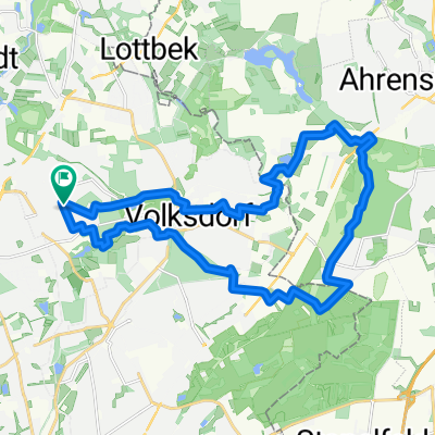
 Volksdorfer Runde
- Distance
- 69.7 km
- Ascent
- 239 m
- Descent
- 240 m
- Location
- Sasel, Hamburg, Germany
 Von Sasel um den Großensse
- Distance
- 53.7 km
- Ascent
- 121 m
- Descent
- 122 m
- Location
- Sasel, Hamburg, Germany
 Von Sasel rund um und durch den Brook
- Distance
- 33.2 km
- Ascent
- 88 m
- Descent
- 91 m
- Location
- Sasel, Hamburg, Germany
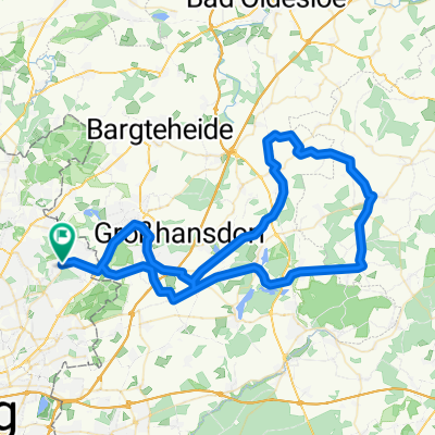
 Hüttbleker Runde
- Distance
- 76.6 km
- Ascent
- 297 m
- Descent
- 307 m
- Location
- Sasel, Hamburg, Germany
 50 km um den Lütjensee
- Distance
- 50.1 km
- Ascent
- 153 m
- Descent
- 153 m
- Location
- Sasel, Hamburg, Germany
 tunneltal
- Distance
- 22.1 km
- Ascent
- 80 m
- Descent
- 83 m
- Location
- Sasel, Hamburg, Germany
 Hamburg-Volksdorf
- Distance
- 81.3 km
- Ascent
- 285 m
- Descent
- 297 m
- Location
- Sasel, Hamburg, Germany
Open it in the app