

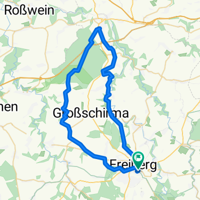
46 km FG - Kleinwaltersdorf - Langhennersdorf - Nobendorf - Cunnersdorf - Bockendorf - Wingendorf - Frankenstein - Wegefarth - Kleinschirma - Stadtwald
A cycling route starting in Freiberg, Saxony, Germany.
Overview
About this route
- -:--
- Duration
- 45.8 km
- Distance
- 438 m
- Ascent
- 438 m
- Descent
- ---
- Avg. speed
- ---
- Avg. speed

Route quality
Waytypes & surfaces along the route
Waytypes
Quiet road
19.4 km
(42 %)
Track
9.2 km
(20 %)
Surfaces
Paved
33.7 km
(74 %)
Unpaved
4.4 km
(10 %)
Asphalt
32.2 km
(70 %)
Gravel
2.5 km
(5 %)
Continue with Bikemap
Use, edit, or download this cycling route
You would like to ride 46 km FG - Kleinwaltersdorf - Langhennersdorf - Nobendorf - Cunnersdorf - Bockendorf - Wingendorf - Frankenstein - Wegefarth - Kleinschirma - Stadtwald or customize it for your own trip? Here is what you can do with this Bikemap route:
Free features
- Save this route as favorite or in collections
- Copy & plan your own version of this route
- Sync your route with Garmin or Wahoo
Premium features
Free trial for 3 days, or one-time payment. More about Bikemap Premium.
- Navigate this route on iOS & Android
- Export a GPX / KML file of this route
- Create your custom printout (try it for free)
- Download this route for offline navigation
Discover more Premium features.
Get Bikemap PremiumFrom our community
Other popular routes starting in Freiberg
 FG->Blockhausen->FG
- Distance
- 60.3 km
- Ascent
- 0 m
- Descent
- 0 m
- Location
- Freiberg, Saxony, Germany
 Freiberg-Grünhainichen-Großrückerswalde
- Distance
- 46.3 km
- Ascent
- 734 m
- Descent
- 513 m
- Location
- Freiberg, Saxony, Germany
 Optisch optimierte FG-DD Route
- Distance
- 48.4 km
- Ascent
- 337 m
- Descent
- 636 m
- Location
- Freiberg, Saxony, Germany
 "Mal kurz in den Tharandter-Wald und zurück"
- Distance
- 76.8 km
- Ascent
- 716 m
- Descent
- 716 m
- Location
- Freiberg, Saxony, Germany
 Freiberg-Nossen-Reichenbach-Freiberg
- Distance
- 45.1 km
- Ascent
- 374 m
- Descent
- 371 m
- Location
- Freiberg, Saxony, Germany
 Freiberg-Niederschöna-Mulde-Münzbachtal
- Distance
- 29.4 km
- Ascent
- 366 m
- Descent
- 384 m
- Location
- Freiberg, Saxony, Germany
 MTB Trainingsrunde Rund um Freiberg
- Distance
- 26.5 km
- Ascent
- 283 m
- Descent
- 281 m
- Location
- Freiberg, Saxony, Germany
 ZuH-Hilbd-Klingenb-TalspKlingenb-Pretschend-Lichtenb-Weißb-FG 51km
- Distance
- 50.7 km
- Ascent
- 503 m
- Descent
- 503 m
- Location
- Freiberg, Saxony, Germany
Open it in the app