

Stonegate to Hoosier Village
A cycling route starting in Whitestown, Indiana, United States of America.
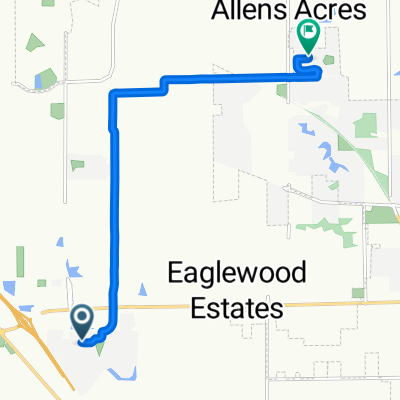
Overview
About this route
Easy ride, mostly in shade. Keeps you off the main roads. Enter Hoosier Village behind FedEx road.
- 41 min
- Duration
- 9.4 km
- Distance
- 50 m
- Ascent
- 58 m
- Descent
- 13.5 km/h
- Avg. speed
- ---
- Avg. speed
Route quality
Waytypes & surfaces along the route
Waytypes
Undefined
9.4 km
(100 %)
Surfaces
Undefined
9.4 km
(100 %)
Continue with Bikemap
Use, edit, or download this cycling route
You would like to ride Stonegate to Hoosier Village or customize it for your own trip? Here is what you can do with this Bikemap route:
Free features
- Save this route as favorite or in collections
- Copy & plan your own version of this route
- Sync your route with Garmin or Wahoo
Premium features
Free trial for 3 days, or one-time payment. More about Bikemap Premium.
- Navigate this route on iOS & Android
- Export a GPX / KML file of this route
- Create your custom printout (try it for free)
- Download this route for offline navigation
Discover more Premium features.
Get Bikemap PremiumFrom our community
Other popular routes starting in Whitestown
 bike to work
- Distance
- 8.1 km
- Ascent
- 24 m
- Descent
- 32 m
- Location
- Whitestown, Indiana, United States of America
 Stonegate to Hoosier Village
- Distance
- 9.4 km
- Ascent
- 50 m
- Descent
- 58 m
- Location
- Whitestown, Indiana, United States of America
 6264 Saddletree Dr, Zionsville to 8830 Amber Stone Ct, Zionsville
- Distance
- 8.8 km
- Ascent
- 19 m
- Descent
- 19 m
- Location
- Whitestown, Indiana, United States of America
 4285 S Main St, Whitestown to 6696 E Stonegate Dr, Zionsville
- Distance
- 4.5 km
- Ascent
- 5 m
- Descent
- 8 m
- Location
- Whitestown, Indiana, United States of America
 6219 Colonial Dr, Whitestown to 5763 White Pine Rd, Whitestown
- Distance
- 8.9 km
- Ascent
- 10 m
- Descent
- 7 m
- Location
- Whitestown, Indiana, United States of America
 6833 E 650 S, Zionsville to 6515 Kingsbury Way, Zionsville
- Distance
- 1.3 km
- Ascent
- 22 m
- Descent
- 23 m
- Location
- Whitestown, Indiana, United States of America
 Recovered Route
- Distance
- 2 km
- Ascent
- 29 m
- Descent
- 30 m
- Location
- Whitestown, Indiana, United States of America
 4050 S 875 E, Zionsville to 4050 S 875 E, Zionsville
- Distance
- 5.5 km
- Ascent
- 6 m
- Descent
- 0 m
- Location
- Whitestown, Indiana, United States of America