

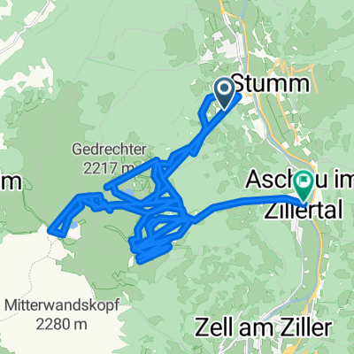
Kaltenbach Schwaz
A cycling route starting in Kaltenbach, Tyrol, Austria.
Overview
About this route
- -:--
- Duration
- 56.5 km
- Distance
- 54 m
- Ascent
- 54 m
- Descent
- ---
- Avg. speed
- ---
- Avg. speed

Route quality
Waytypes & surfaces along the route
Waytypes
Track
29.3 km
(52 %)
Quiet road
18.8 km
(33 %)
Surfaces
Paved
55.7 km
(99 %)
Asphalt
54.7 km
(97 %)
Paving stones
0.5 km
(<1 %)
Continue with Bikemap
Use, edit, or download this cycling route
You would like to ride Kaltenbach Schwaz or customize it for your own trip? Here is what you can do with this Bikemap route:
Free features
- Save this route as favorite or in collections
- Copy & plan your own version of this route
- Sync your route with Garmin or Wahoo
Premium features
Free trial for 3 days, or one-time payment. More about Bikemap Premium.
- Navigate this route on iOS & Android
- Export a GPX / KML file of this route
- Create your custom printout (try it for free)
- Download this route for offline navigation
Discover more Premium features.
Get Bikemap PremiumFrom our community
Other popular routes starting in Kaltenbach
 Zillertaler Höhensteuer.2
- Distance
- 27.1 km
- Ascent
- 1,361 m
- Descent
- 1,921 m
- Location
- Kaltenbach, Tyrol, Austria
 Altenwörth Donau Donnauau
- Distance
- 7.6 km
- Ascent
- 413 m
- Descent
- 390 m
- Location
- Kaltenbach, Tyrol, Austria
 Platzlalm
- Distance
- 23.9 km
- Ascent
- 1,273 m
- Descent
- 1,851 m
- Location
- Kaltenbach, Tyrol, Austria
 Innere Embergstraße 6, Kaltenbach nach Loasweg 9, Pill
- Distance
- 24.7 km
- Ascent
- 1,259 m
- Descent
- 206 m
- Location
- Kaltenbach, Tyrol, Austria
 Postfeldstraße 7, Kaltenbach nach Hauptstraße 455, Mayrhofen
- Distance
- 18.5 km
- Ascent
- 488 m
- Descent
- 387 m
- Location
- Kaltenbach, Tyrol, Austria
 Zillertal von Kaltenbach nach Mayerhoven
- Distance
- 36.3 km
- Ascent
- 241 m
- Descent
- 243 m
- Location
- Kaltenbach, Tyrol, Austria
 Hochzillertal III Kristallhütte Kaltenbach
- Distance
- 18.5 km
- Ascent
- 425 m
- Descent
- 1,600 m
- Location
- Kaltenbach, Tyrol, Austria
 110101_Kaltenbach
- Distance
- 56.5 km
- Ascent
- 5,557 m
- Descent
- 5,781 m
- Location
- Kaltenbach, Tyrol, Austria
Open it in the app