

Gozo ferry - Blue hole
A cycling route starting in Mġarr, Għajnsielem, Malta.
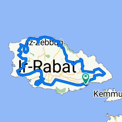
Overview
About this route
- -:--
- Duration
- 13 km
- Distance
- 201 m
- Ascent
- 198 m
- Descent
- ---
- Avg. speed
- ---
- Avg. speed

Route quality
Waytypes & surfaces along the route
Waytypes
Quiet road
6.2 km
(48 %)
Road
3.7 km
(29 %)
Surfaces
Paved
10.2 km
(79 %)
Unpaved
1.4 km
(11 %)
Asphalt
10.2 km
(78 %)
Gravel
1.4 km
(11 %)
Continue with Bikemap
Use, edit, or download this cycling route
You would like to ride Gozo ferry - Blue hole or customize it for your own trip? Here is what you can do with this Bikemap route:
Free features
- Save this route as favorite or in collections
- Copy & plan your own version of this route
- Sync your route with Garmin or Wahoo
Premium features
Free trial for 3 days, or one-time payment. More about Bikemap Premium.
- Navigate this route on iOS & Android
- Export a GPX / KML file of this route
- Create your custom printout (try it for free)
- Download this route for offline navigation
Discover more Premium features.
Get Bikemap PremiumFrom our community
Other popular routes starting in Mġarr
 GOZO
GOZO- Distance
- 35.5 km
- Ascent
- 623 m
- Descent
- 535 m
- Location
- Mġarr, Għajnsielem, Malta
 in Gozo
- Distance
- 34 km
- Ascent
- 626 m
- Descent
- 601 m
- Location
- Mġarr, Għajnsielem, Malta
 Gozo Coastal Walk
- Distance
- 67.7 km
- Ascent
- 1,765 m
- Descent
- 1,766 m
- Location
- Mġarr, Għajnsielem, Malta
 Gozo Route
- Distance
- 36.7 km
- Ascent
- 640 m
- Descent
- 664 m
- Location
- Mġarr, Għajnsielem, Malta
 Gozo
Gozo- Distance
- 46.4 km
- Ascent
- 522 m
- Descent
- 520 m
- Location
- Mġarr, Għajnsielem, Malta
 ROUND GOZO BY ROADBIKE
- Distance
- 49 km
- Ascent
- 937 m
- Descent
- 916 m
- Location
- Mġarr, Għajnsielem, Malta
 MALTA GOZO TRIP
- Distance
- 41.2 km
- Ascent
- 689 m
- Descent
- 690 m
- Location
- Mġarr, Għajnsielem, Malta
 Tour of Gozo
- Distance
- 52 km
- Ascent
- 755 m
- Descent
- 727 m
- Location
- Mġarr, Għajnsielem, Malta
Open it in the app