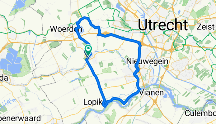
Cycling Route in Montfoort, Provincie Utrecht, Netherlands
Montfoort Nederijnseplas Harmelen 48km

Open this route in Bikemap Web
Distance
Ascent
Descent
Duration
Avg. Speed
Max. Elevation
Cycling Route in Montfoort, Provincie Utrecht, Netherlands

Open this route in Bikemap Web
Van Montfoort naar de lekdijk bij Jaarsveld en dan richting IJsselstein. Door IJsselstein en dwarsdoor de Nederijnseplas richting knooppunt Ouderijn paralel langs A2. Langs A12 naar Reijerscop en oversteken naar Harmelen. Langs de Leidserijn naar Woerden en over Cattenbroek weer terug naar Montfoort.
This route is based on Montfoort A'Dam-rijnkanaal en Leidsrijn 48km .

You can use this route as a template in our cycling route planner so that you don’t have to start from scratch. Customize it based on your needs to plan your perfect cycling tour.