

Tacho-Such-Tour 24.7.18
A cycling route starting in Mainzweiler, Saarland, Germany.
Overview
About this route
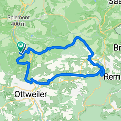
gefahren am 24.7.18 wegen verlorenem Sigma Tacho (Heimweg Mittagschicht), leider nicht gefunden; Zeit 1:51h; Schnitt 10,7km/h; Wetter sonnig 26°C
- -:--
- Duration
- 19.3 km
- Distance
- 372 m
- Ascent
- 373 m
- Descent
- ---
- Avg. speed
- ---
- Max. altitude
Route quality
Waytypes & surfaces along the route
Waytypes
Track
10 km
(51 %)
Quiet road
2.4 km
(13 %)
Surfaces
Paved
6.7 km
(35 %)
Unpaved
8.4 km
(43 %)
Gravel
4.4 km
(23 %)
Paved (undefined)
4 km
(21 %)
Continue with Bikemap
Use, edit, or download this cycling route
You would like to ride Tacho-Such-Tour 24.7.18 or customize it for your own trip? Here is what you can do with this Bikemap route:
Free features
- Save this route as favorite or in collections
- Copy & plan your own version of this route
- Sync your route with Garmin or Wahoo
Premium features
Free trial for 3 days, or one-time payment. More about Bikemap Premium.
- Navigate this route on iOS & Android
- Export a GPX / KML file of this route
- Create your custom printout (try it for free)
- Download this route for offline navigation
Discover more Premium features.
Get Bikemap PremiumFrom our community
Other popular routes starting in Mainzweiler
 Tacho-Such-Tour 24.7.18
- Distance
- 19.3 km
- Ascent
- 372 m
- Descent
- 373 m
- Location
- Mainzweiler, Saarland, Germany
 Mainzweiler-Biberweg-Rheinstrasse- Mainzweiler
- Distance
- 29.4 km
- Ascent
- 444 m
- Descent
- 491 m
- Location
- Mainzweiler, Saarland, Germany
 Remmesweiler Saarbrücken über Hüttigweiler Fischbach
- Distance
- 42.1 km
- Ascent
- 828 m
- Descent
- 905 m
- Location
- Mainzweiler, Saarland, Germany
 WND Wendalinum-Park mit dem Mountainbike
- Distance
- 42.5 km
- Ascent
- 334 m
- Descent
- 334 m
- Location
- Mainzweiler, Saarland, Germany
 Genussradeln-Tour 29.4.18
- Distance
- 24.9 km
- Ascent
- 379 m
- Descent
- 381 m
- Location
- Mainzweiler, Saarland, Germany
 Runde ums Dorf 23.6.19
- Distance
- 23.6 km
- Ascent
- 385 m
- Descent
- 386 m
- Location
- Mainzweiler, Saarland, Germany
 kurze Morgenrunde 16.11.17
- Distance
- 19.9 km
- Ascent
- 347 m
- Descent
- 339 m
- Location
- Mainzweiler, Saarland, Germany
 Sonntagstour zum Wolfsborner Hof
- Distance
- 47.8 km
- Ascent
- 681 m
- Descent
- 630 m
- Location
- Mainzweiler, Saarland, Germany
Open it in the app